Departure at the Plan Ravet car park in Méribel Mottaret.
Marked route (purple signs and markers).
Groomed route except on a section of 120 meters of elevation.
- Sport
WINTER PATH "Path of the Vallon" (on snowshoes only)

Very nice walk that ends in an altitude restaurant.
Possibility to go up or down in ski lifts.
Possibility of continuing on a climb to the summit of Mont Vallon gondola (highest point of the valley of Meribel).
Sport WINTER PATH "Path of the Vallon" (on snowshoes only) Méribel
About
1 1

Make a stop at the restaurant Plan des Mains and continue by gondola to the summit of Mont Vallon for its exceptional panorama
Prices
Free access.
Reception
Follow the signs "Chemin du Vallon" and purple milestones
State of maintenance and the opening/closing of footpaths and snowshoes is updated daily on www.meribel.net
Closed in case of avalanche risk and during the PIDA (avalanche trigger) ask at the ski patrol desk or at the Tourist Office
Period of practice
From 21/12 to 21/04.
Closed in case of avalanche risk and during the PIDA (avalanche trigger) ask at the ski patrol desk or at the Tourist Office before going in order to check if the marking has been done.
Contacts
Access
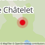
Start from Méribel-Mottaret tourist Office or from Châtelet bus Stop or from car park Plan Ravet Méribel-Mottaret
In order to help you : take the "Méribel resort map" starting points are indicated more precisely by orange arrows as well as the winter footpath map

