Snowshoe route n°13: Le Replat
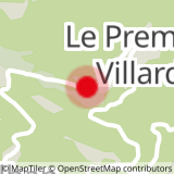
Departure: Saint Alban des Villards - Le Premier Villard
Description: Take the forest track, at the first bend, continue left on the Bois du Nant track. Follow this track until you reach Le Replat, where there are chalets.
Return by the same route.
- Sport
Snowshoe route: Le Replat
Map of walking and snowshoeing routes available for download on this page and from the Espace Glandon Tourist Office.
About
Prices
Free access.
Reception
Period of practice
From 02/12 to 14/05.
Subject to snow conditions.
Equipments
- Parking
Contacts
Access
