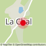
Snowshoe route n°8: Ascent of the Ormet - Bois de La Chal
Difficult walk because very steep to reach the top of the Ormet chairlift. After parking above the hamlet of La Chal, go down the national road until you take the path starting above the village. The path goes deep into the forest towards the Ormet chairlift on a narrow and steep route. After a switchback climb under the trees, you will reach the top of the Ormet chairlift and enjoy a lovely view of the Villards valley.
You can then continue your walk towards the Auberge restaurant du Coin, towards the summit of Ormet Sup, enjoy a descent by chairlift or leave by the same path.
Note: very difficult route and very steep in its entirety.
- Sport
Snowshoe route: Ascent of Ormet - Bois de La Chal
Map of walking and snowshoeing routes available for download on this page and from the Espace Glandon Tourist Office.
About
Prices
Free access.
Reception
Period of practice
From 02/12 to 14/05.
Subject to snow conditions.
Contacts
Access
