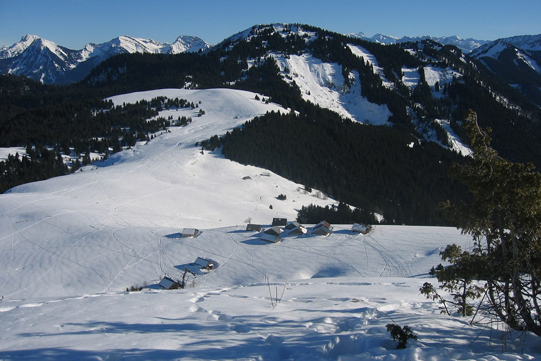
Route details: Take the Chemin de la Combe (PDIPR signage) for about 200m from the car park by Alpaga chalet then branch off left over the little stream (yellow markings) and get bcak on the Meille route. After the chalets in Haute Meille, head north until you reach the Moilletaz chalets. PLEASE NOTE: Do not take this road in summer as there's a risk of avalanches.
Turn left to the Tré-le-Saix chalets.
Go past the chalets in a westerly direction and go up Rocher de la Mottaz where you will find the Sacré Coeur statue.
Enjoy fantastic views of Bellevaux, Hirmentaz mountain and the Roc d'Enfer.
Go back down the same road to reach your starting point.
We recommend that you keep to the route and are vigilant on the Rocher de la Mottaz.
- Sport
"L'Alpage de Tré-le-Saix" Snowshoe Trek
Learn how the Lac de Vallon came into being.
This trek will give you a unique insight into the Lac de Vallon which was formed by a landslide in 1943. Explore where the ground first fell and is still visible today.
Sport "L'Alpage de Tré-le-Saix" Snowshoe Trek Bellevaux
About
Prices
Free
Reception
Services
- Pets welcome
Contacts
Access
