Two itineraries will allow you to reach the Pointe du Cuchet summit
(small loop and large loop).
Practical information :
IGN site: Pointe du Cuchet
Departure altitude: 1040m (near the Coche reservoir)
Altitude Pointe du Cuchet: 1679m
Vertical drop: 660m
Duration: 3h30 to 4h00 (walking)
Distance: about 7km
Beaconing : Trails always visible and very well marked, several signs and beacons (yellow on green background) and "woodpeckers" on the first part .
Precautions : No technical difficulties on this route.
At the arrival, two orientation tables are very useful reading tables to locate the massifs in line of sight. Mont-Blanc is straight ahead!
- Mountain, Peak
Pointe du Cuchet
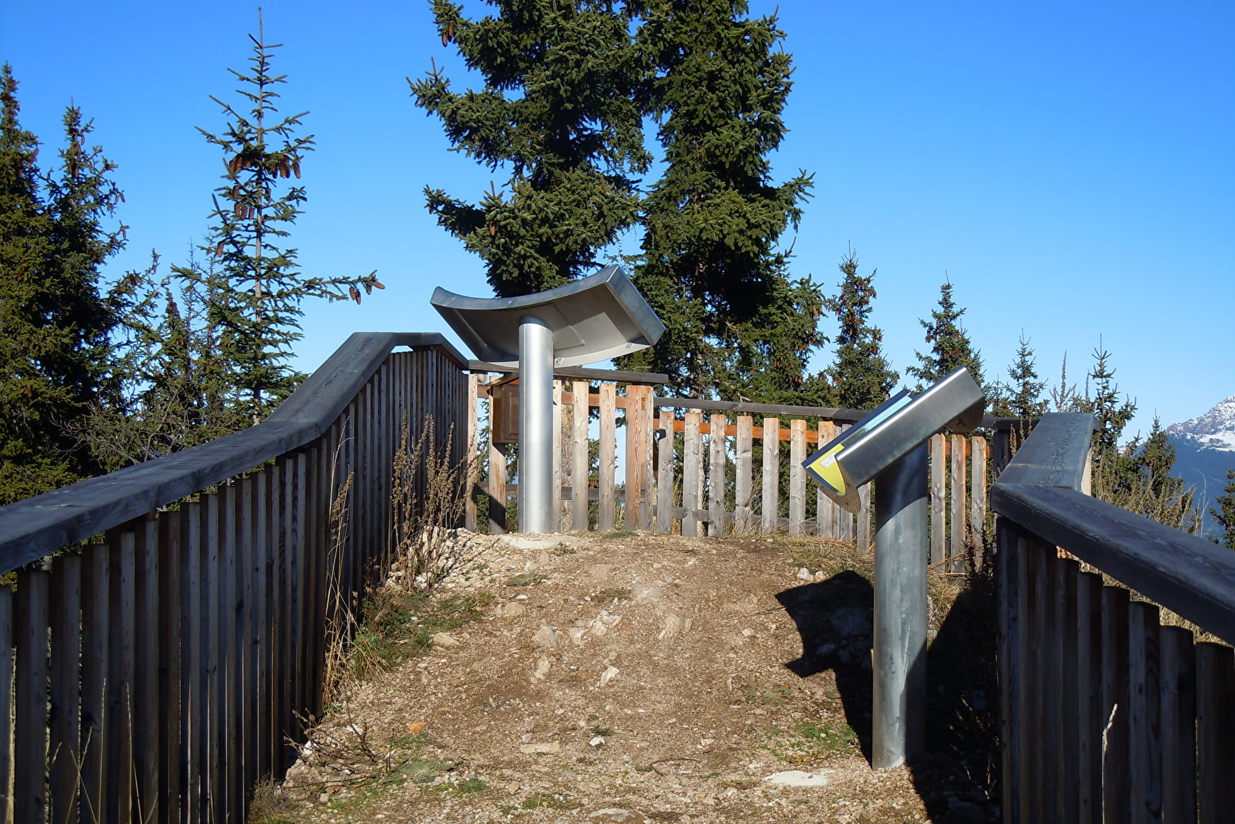
This summit of the Belleville valley culminates at 1679 m. At the arrival, it offers a panoramic view on the Mont-Blanc, the Grande Casse, the Grand-Perron and the Niélard.
About
1 1

Prices
Free access.
Reception
Opening
All year round.
Subject to favorable snow and weather conditions.
Services
- Pets welcome
- Orientation board
Contacts
Access

