Departure: Tourist Office - La Toussuire
Distance and duration: 4.7 km - 2h
Difference in height: 140 m
From the Tourist Office, turn left to go up the main shopping street. Up there, turn left following the signs "Grande Verdete", "Ouillon", "Retenue d'eau", and "Champ Pérouze".
In "Les Ravières", follow "Boucle Champ Pérouse" in direction of "La Lasaz".
In "La Lausaz", you can go up (200 m) and see La Lauzaz cross.
Go down on the path and turn right to go back to RD78 road. Go back to the Tourist Office.
- Sport
Champ Pérouse walk
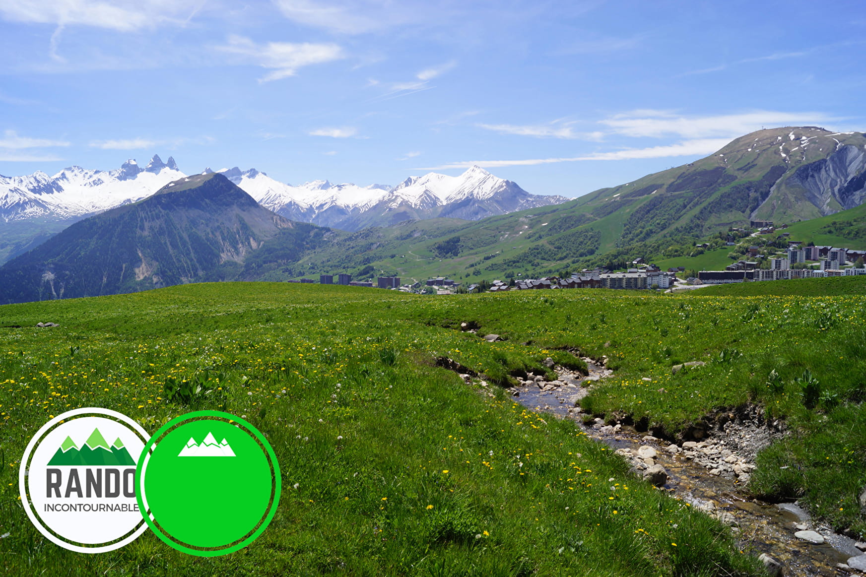
Beautiful walk on the highs of La Toussuire, at 1850 m of altitude, with pretty alpine chalets, in the middle of flowers fields.
Beautiful pastures and herds
Green level and Essentiel Hike
Sport Champ Pérouse walk La Toussuire
About

Signs
Yelloow signs with direction and walking time
Topoguides references
Buy our 30 walks guide at La Toussuire Tourist Office (€5). Area: Villarembert, Le Corbier, Fontcouverte, La Toussuire, Saint Pancrace, Les Bottières, Jarrier
Further informations
Stone, Ground
1 4


Prices
Free access.
Reception
On your way, you may see cows or sheeps pens. Please, be careful of guarding dogs
Services
- Pets welcome
- Car park
Contacts
Access
- Not accessible in a wheelchair


