
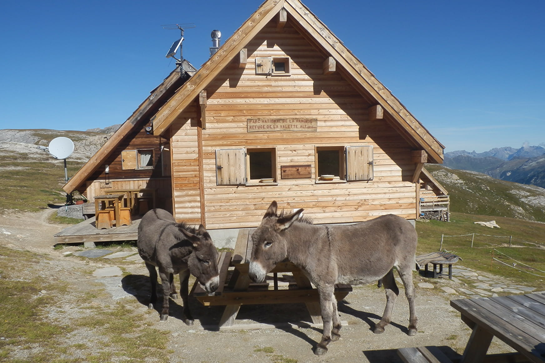
In the heart of the Vanoise National Park, discover the Valette refuge, perched at an altitude of 2,585 meters. An essential stopover for touring hikers, or simply a little corner of paradise for a well-deserved break at the foot of the Vanoise glaciers. Take advantage of your hike to discover the old refuge and nearby lake. The exposure of the slope favors updrafts, ideal for birds of prey (golden eagles, bearded vultures...) - a life-size spectacle!
- Sport
Le Refuge de la Valette - Return walk
Glaciers, waterfalls, lakes, chamois, and even ptarmigans are the fantastic ingredients that make up this hike.
Sport Le Refuge de la Valette - Return walk Pralognan-la-Vanoise
About

Map references
Pralognan-la-Vanoise trail map.
Further informations
Rock, Stone, Ground, Grit
1. From the Prioux parking lot, cross the bridge and take the departmental road in the direction of Pont de la Pêche, for about 50 m, to reach the start of the Bévériers trail (trail no. 38) on the other side of the road.
2. Continue along this path under cover of arcosses (alders in local dialect) to the cirque des Nants via the pont des Nants. At this point, you enter the Vanoise National Park.
3. Continue on the same path (trail no. 38) to the Valette refuge.
4. On your return, take the same route.
LOOP VARIANT : REFUGE DE LA VALETTE (2,585 m) +7h, +1,175 m ascent, +14.5 km
BY LE SENTIER DU PAS DE L'ÂNE (very difficult)
This route is a myth in Pralognan! A magnificent viewpoint over the village, it is an interesting alternative for very good walkers. It should be avoided in wet weather or after a heavy storm.
1. From the "Le Chamois" campsite (do not enter the campsite), continue straight ahead to the edge of the forest, where the track leading to the Pont de Chollière turns left (path no. 34).
2. At the intersection, fork left and take the Pas de l'Âne path (path no. 30) through the Isertan forest.
3. Continue up (path no. 30b), leaving the Rocher Blanc path (path no. 35) on your right and the Nanette path (path no. 29) on your left.
4. At the next junction, leave the Cascades path (path no. 28) on your left and continue uphill on the Pas de l'Âne path (path no. 30b).
5. Above the Pas de l'Âne fork right onto the path leading to the Valette refuge (path no. 33), crossing the Tambour pass (tricky if snow-covered).
6. On the way down, take the Bévériers path (path no. 38) and cross the main road to reach the hamlet of Les Prioux.
7. Follow the pastoral path through the hamlet to Pont de Gerlon (path no. 37).
8. Cross the bridge and descend to the right bank of the Doron de Chavière via the Rocher Blanc forest track (trails no. 36 and 34).
Prices
Free access.
Reception
Period of practice
From 15/06 to 14/09/2024.
Snow in June.
Subject to favorable snow and weather conditions.
Contacts
Access
Nearby car park: Prioux car park