To activate geolocation, click on the map icon.
- Sport
Le sommet des Râtissières - Hiking trail
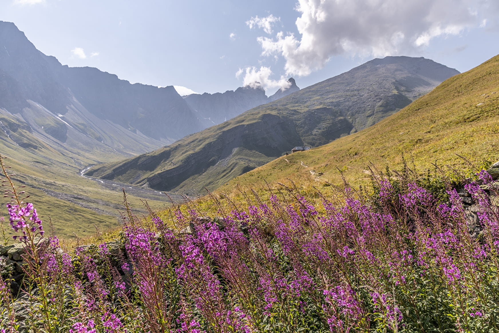
Itinerary over varied terrain to a summit in a central position between the Col du Télégraphe and the Col du Galibier. Up here, we enjoy an impressive view of Valloire and the surrounding area.
Sport Le sommet des Râtissières - Hiking trail Valloire
About

Signs
Signposted to Commanderaut, then unmarked to the summit.
Map references
Map of Valloire hiking and mountain biking trails, on sale at the tourist office. IGN map 3435ET VALLOIRE - Aiguilles d'Arves / Col du Galibier is on sale in Valloire shops.
Further informations
Rock, Stone, Ground
- Find out about weather conditions before you leave.
- Inform someone of your itinerary, as communication may be limited.
- Make sure you leave in the morning, so as not to be caught unawares at night, and let someone know if you're going alone.
- The routes you take are your own responsibility.
- Choose an itinerary suited to your physical and technical ability. If in doubt, don't hesitate to contact mountain professionals.
- Make sure you're properly equipped for safe hiking and weather conditions.
- This hike is best done in summer, when there's no more snow.
There are a few things you can do to make your experience safer and more enjoyable. Walking poles improve balance, warm clothing and regular hydration are essential.
Carry a water bottle and snacks to keep your energy up. Protect yourself from the sun with sunscreen and sunglasses. Don't forget binoculars to add a touch of observation to your adventure.
Start: Car park below the Bonnenuit altiport.
1/ Follow the signposted path to the Refuge des Aiguilles d'Arves.
2/ At Commandraut, climb obliquely to the right to the Puy ridge, which you follow to the summit.
Prices
Free access.
Reception
To keep the mountains a pleasure, choose an activity suited to your level of experience and physical ability. Check the weather and seek advice from qualified professionals, and tell someone about your itinerary. Set off with the right equipment: good shoes and walking poles. In your rucksack, carry a water bottle and snacks to keep your energy levels up, a survival blanket or warm clothing. Protect yourself from the sun with sunscreen and sunglasses. Don't forget binoculars to add a touch of observation to your adventure.
Pets must be kept on a leash.
Period of practice
From 01/05 to 01/11.
Subject to favorable snow and weather conditions.
Services
- Pets welcome