To activate geolocation, click on the map icon.
- Sport
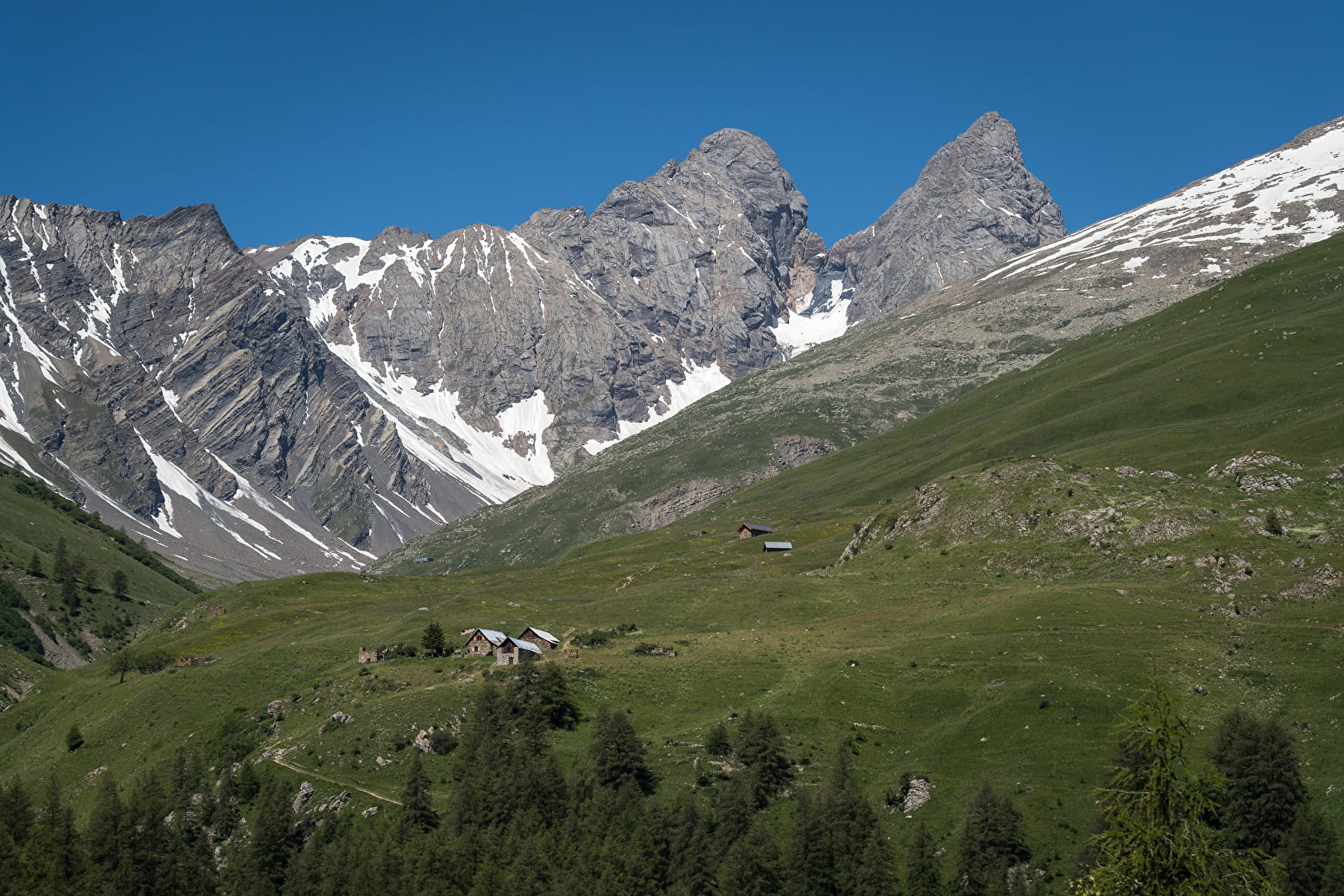
the Aiguilles d'Arves combe
Open your eyes you will be able to observe marmots.
You will discover the great circus formed by these three Savoyard needles.
Sport the Aiguilles d'Arves combe Valloire
About

Signs
The trail is marked with yellow directional signs.
Map references
Map of Valloire walking and mountain biking trails, on sale at the tourist office
Further informations
Rock, Ground
When hiking, there are a few things you can do to make your experience safer and more enjoyable. Walking poles (even on roads) improve balance in icy conditions, crampons provide grip, and regular hydration is essential.
Carry a water bottle and snacks to keep your energy up. Protect yourself from the sun with sunscreen and sunglasses. Don't forget binoculars to add a touch of observation to your adventure.
Finally, check weather conditions and avalanche risks before you set off. Inform someone of your itinerary, as communication may be limited. These small adjustments will help you make the most of your getaway.
Departure point: Car park below the Bonnenuit altiport. 1 - Take the forest path leading to the Chalets des Aiguilles. 2 - Continue to the Aiguilles d'Arves refuge. 3 - After the refuge, climb up the combe des Aiguilles to the foot of the large névé (until the end of July) arriving near the torrent. 4 - Descend by the same route (or, at the Commendraut junction, return to La Rivine or Les Verneys via Le Vallon).
Prices
Free access.
Reception
Period of practice
From 15/05 to 15/10.
Subject to favorable snow and weather conditions.
Services
- Accommodation
- Restaurant