Along the path leading to the hamlet of Colonnaz, next to the torrent of Epine, you will be able to guess the remains of the mine exploited from 1750. Then the passage to the col de la Frête near the Tête Louis Philippe and its belvedere for an exceptional view of the Arve valley on the Sallanches side and the first ramparts of the Aravis with the Pointe Percée and the Pointe d'Areu. Return via the Col de Cou (possible variant with a 30 minute diversions to the lake of Flaine), under the Pointe de l'Arbaron, passing by the tête du Chevet (lookout point) and returning to the Plaine Joux mountain pasture.
- Sport
La Colonnaz - Col de Frête - Col de Cou
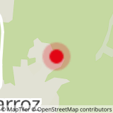
Pas l'Ane car park, head in the direction of La Colonnaz, Col de la Frête. Optional detour to Tête Louis-Philippe (30 min round trip). Direction Col de Cou. Optional detour to Lac de Flaine 30 min. Tête du Chevet and return following signs to Les Carroz.
Sport La Colonnaz - Col de Frête - Col de Cou Les Carroz-d'Arâches
About

Further informations
Stone, Rock, Ground
1 5


Prices
Free of charge.
Reception
Services
- Pets welcome


