The Bise and Ubine hike, nestled in the heart of the Chablais, in the Abondance valley, will offer you an exceptional view of various alpine peaks.
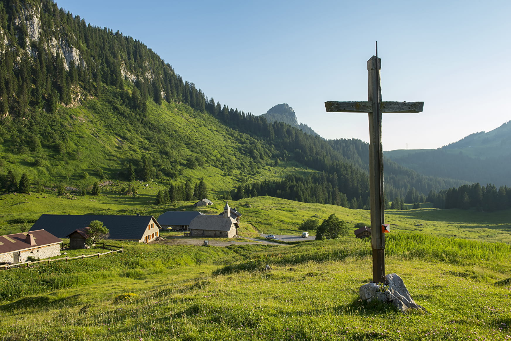
Starting from the car park of the Bise chalets, you will walk on a downhill forest path then you will reach the Fontaine lake. Following a forest path with a slight difference in altitude, you will then reach the Ubine refuge, where you can take advantage of the tables and an outdoor pool to take a break. The small Ubine chapel was built during the French revolution.
You will cross several mountain pastures during this hike, these are the ones that allow the cows to graze and then the farmers to produce Abondance, the famous cheese characteristic of the territory and the object of a protected designation of origin.
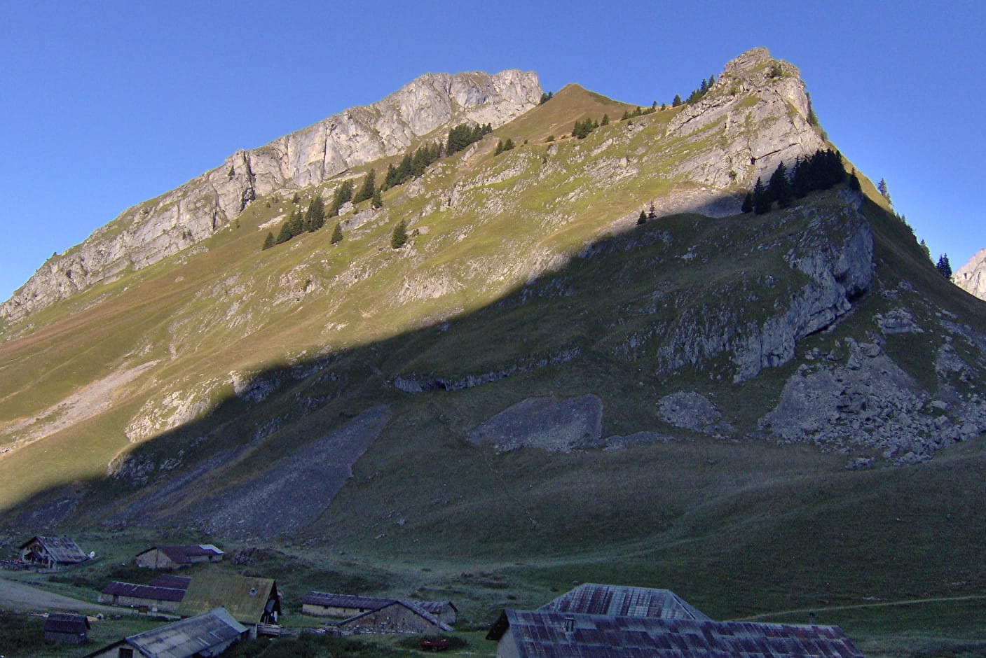
You will then reach the Col d'Ubine, under the vertiginous ridge of Mont Chauffé and descend to the Chalets de Mens.
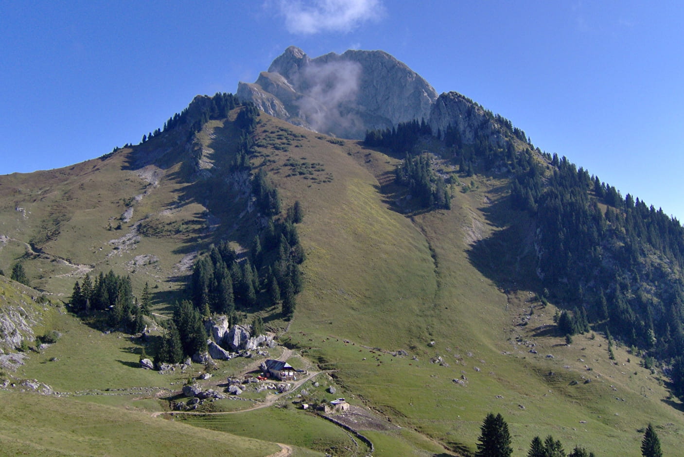
You will then go up by the Pas de la Bosse with a superb view of the Cornettes de Bise, a nice descent on the GR5 trail to reach the Chalets de Bise and its refuge.
- Sport
Hiking from Bise to Ubine
A really lovely hike over high mountain pastures and forests, with magnificent views of the jagged mountains, the Natura 2000 sites of Cornettes de Bise and Mont de Grange. The impressive cliff faces of Mont Chauffé contrast with the gentle slopes of summer grazing land.
About

Signs
Departmental markings called P.D.I.P.R. on beige metal panel and green writing.
Map references
Map of the Portes du Soleil hiking trails in France and Switzerland TOP 25 IGN N°3528 ET Morzine Massif du Chablais Les Portes du Soleil
Topoguides references
On sale in the tourist offices of the Abondance valley.
Further informations
Stone, Ground


1/ From "Chalets de Bise (parking)", take the direction "Ubine (Refuge) by Lac de Fontaine". Continue to follow "Ubine (Refuge)" at the intersections "Les Chatellets", "Lac de Fontaine", "Marais de Léchère" and "Les Maupas".
2/ At the first signpost "Ubine (Refuge)", continue towards "Ubine (Parking)" and then at the second signpost "Ubine (Refuge)", follow the direction "Chalets de Bise (Refuge) by Pas de la Bosse". At the intersection "Col d'Ubine", take the path on the right, always towards "Chalets de Bise (Refuge) par Pas de la Bosse".
3/ At the level of "Chalets de Mens", "Chalet de la Combe au Trot", "Combe au Trot (Haut)", "Pas de la Bosse" and "Chalet de Bise", continue in the direction of "Chalets de Bise (Refuge)
4/ Once you have reached the Chalets de Bise Refuge, go back to your starting point " Chalets de Bise (Parking) ".
Prices
Free access.
Reception
Whatever your hike, remember to take cereal bars, sufficient water, sunglasses, sun cream, a small first aid kit, as well as clothes adapted to your outing according to the season and the weather forecast.
Dogs must be kept on a leash because of the presence of herds, Natura 2000 reserve and hunting reserve.
Period of practice
From 15/05 to 20/11.
Accessible except during snow and depending on weather conditions.
Please check with the Tourist Office for the latest information on access conditions. This route is usually suitable for strong walkers during spring, summer, and autumn, except in adverse weather.
- Pets welcome
- Car park
- Parking
Contacts
Access
Access (by car):
From Thonon-les-Bains, take the D22 towards Vacheresse then leave the village via the hamlets of Villard and Revenette, towards Bise.