
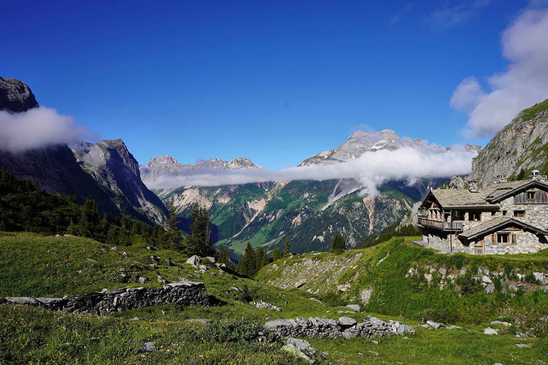
DAY 1: Parking du Laisonnay-d'en-Bas (1560 m) - Refuge du col du Palet (2587 m)
Ascent +: 1348 m
Ascent - : 317 m
Total time 5h30 excluding breaks
Points of interest: view of the largest alder grove in France between the Grand Bec and Epéna peaks,
DAY 2: Refuge du col du Palet (2587 m) - Refuge de la Leisse (2487 m)
Ascent +: 653 m
Ascent - : 756 m
Total time 5h10 excluding breaks
Points of interest: chamois on the right bank of the torrent de la Leisse
DAY 3: Refuge de la Leisse (2487 m) - Refuge des Barmettes (2012 m)
Ascent +: 417 m
Difference in altitude - : 894 m
Total time 4h30 excluding breaks
Points of interest: at the Col de la Vanoise, lakes and view of the Grande Casse glacier.
DAY 4: Refuge des Barmettes (2012 m) - Refuge du Grand Bec (2405 m)
Ascent +: 554 m
Difference in altitude - : 158 m
Total time 4h excluding breaks
Points of interest: chamois, ibex, view of the Vanoise glaciers, moraines.
DAY 5: Refuge du Grand Bec (2405 m) - Parking du Laisonnay (1560 m)
Ascent +: 333 m
Difference in altitude - : 1175 m
Total time 4h30 excluding breaks
Points of interest: spruce forest, Champagny-le-Haut hamlet and nature trail.
Book your accommodation online at
www.refuges-vanoise.com
- Sport
5-day walking tour - Tour de la Grande Casse
The Tour de la Grande Casse is an emblematic hike in the Vanoise, offering magnificent views and scenery !
About

Signs
GR5 and GR 55 (red and white paint + yellow signs)
Map references
Carte IGN : TOP 25 3633 ET Tignes - Val d’Isère - Haute-Maurienne - Parc naturel de la Vanoise et TOP 25 3534OT Les Trois Vallées - Modane - Parc naturel de la Vanoise
Topoguides references
Topoguide FFRandonnée: GR La Vanoise - Parc national de la Vanoise
Reception
Vanoise National Park protected area
Period of practice
Itinerary accessible outside snow periods and subject to favorable weather conditions. Check with the Tourist Office beforehand for current access conditions. We strongly advise you to book accommodation in advance (please note that opening dates vary according to hut).
Contacts
Access
IGN map: TOP 25
3633 ET Tignes - Val d'Isère - Haute-Maurienne - Parc naturel de la Vanoise + TOP 25 3534OT Les Trois Vallées - Modane - Parc naturel de la Vanoise
Topoguide FFRandonnée : GR La Vanoise - Parc national de la Vanoise
Access: Albertville then follow signs for Moûtiers - Haute Tarentaise.
From Moûtiers, go to Bozel then Champagny-en-Vanoise.
In Champagny-en-Vanoise, follow the road towards
to Champagny-le-Haut, pass the refuge-porte du Bois and
continue up to the end of the road, at Laisonnayd'en-Bas.