- Round trip : 1h15
- Level : Easy (regular slope then flat)
- Shuttle stop : Les Chambons
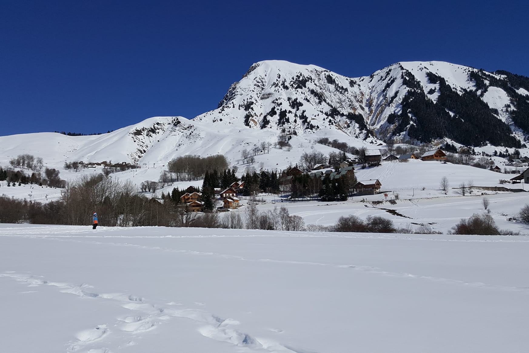
- Interest : Important agricultural and historical place, typical hamlet.
Start at the bridge at the entrance of the hamlet Les Chambons.
Right before reaching the chapel “Saint Antoine et Saint Roch”, follow the road towards “Le Poingt - La Ville”. Keep going up the hair pined bend road, with behind you, the landscape opens onto residentials and touristic hamlets and the ski resort.
Info: this road is not paved and is one of the hardest to maintain in a good shape for the village of Saint Jean d’Arves. In fact, it is located on the edge of the glacial morain which is in perpetual erosion.
Once you have reached the top of the hair pined bend road, a path directs you towards “Altisurface ” (snowshoeing walk altisurface and les Buffettes).
Keep walking on the road, which will be flat soon. When you reach the fork, take the right road ahead to get to the hamlet La Ville where there will be a farm. At the crossroad, you will see the mountain Montzard (2107m) across from you. With luck, you might be able to see buffs.
Follow the road on your left to reach the hamlet Le Poingt and its traditional houses. Right after the left turn, you can make a round trip to the chapel “Saint Laurent”, fully restored by the local heritage charity. Keep walking on the road that climbs slightly left to reach the fork. Right before the fork, below left, a water reservoir (locally called “bachal”) is supplied by a maintained source.
Start coming back and at the end of the plateau, close to the hiking sign “Le Plateau”, a bench on your right, offers you a panoramic break: l’Ouillon all the way to the left, the Aiguilles d’Arves (3514m) and the Mount Charvin (2207m) and its forest in between.
- Sport
Les Chambons - Le Poingt walk - n°4
Come discover some of Saint Jean d'Arves' hamlets. easy walk for everybody.
Les chambons would come from "campus bonus" : good field (fertile).
About

Further informations
Groomed trail, Grit
1 1

Prices
Free access.
Reception
Steady slope, then plateau.
Period of practice
From 19/11 to 30/04.
Subject to favorable snow and weather conditions.
Services
- Pets welcome
- Parking nearby
