


As you make your way along the path through the high-altitude meadows,
you'll come across alpine chalets with unique shapes. These chalets are
designed to withstand avalanches, with some being semi-buried or protected
by a "tourne," which is a stone prow. Amid the glaciers of Albaron, Vallonnet,
and Evettes, you make your way along this breathtaking trail that overlooks
the Sources de l'Arc cirque. You pass a number of lakes and the views never
cease to amaze you. Azures and turquoises unfold before your eyes, in a
stunning parade of shades of blue. A few chamois can be seen in the distance.
You get to the refuge, see how perfectly it blends into the rugged background
of the mountains. Check out the view of the lakes from above. It feels like
you're at the end of the world! This is a dream opportunity to spend a night
under the stars and the crystalline sky of the high-altitude mountains. Make
a wish for every shooting star!
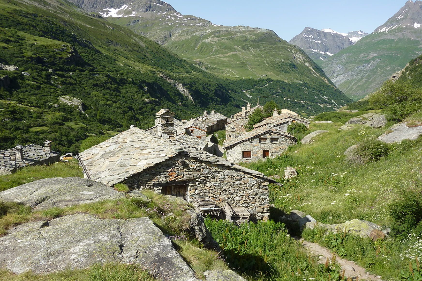
On your way down, take some time to visit the hamlet of l'Écot and Bonneval-sur-Arc. Isn't that Sebastian who running down an alley, followed by his
faithful Belle?
- Sport
Balcon et Refuge du Carro
Savoie Mont Blanc's choice
This stunning mountain trail offers amazing views of the Albaron, Vallonnet and Evettes glaciers, their reflections mirrored in the surrounding mountain lakes. The shades of blue, from azure to turquoise, are always surprising.
Sport Balcon et Refuge du Carro Bonneval-sur-Arc
About
Signs
Mixed signposting (PR, PNV and GR)
Map references
TOP 25 IGN - 3633 ET- Tignes-Val d'Isère / Haute-Maurienne Map and booklet "Balades et Randonnées Haute Maurienne Vanoise" (sold at 10 € in the Tourist Office)
Topoguides references
TopoGuide "Savoie Mont Blanc on foot Black route n°103
Further informations
Rock, Stone, Ground
1 4


To guide you in the field, consult the "step-by-step" directional diagram provided in pdf.
Prices
Free access.
Reception
Period of practice
From 15/05 to 15/10.
Subject to favorable snow and weather conditions.
Equipments
- Parking
Contacts
Access
By bus: Line 6 - Pont de l'Ouilletta stop


