Discovering the Aiguille Percée, a geological phenomenon unique in its scale in the Haute Tarentaise. Do not miss the orientation table: up there, the landscape is magnificent!
- Sport
Aiguille Percée trail running itinerary
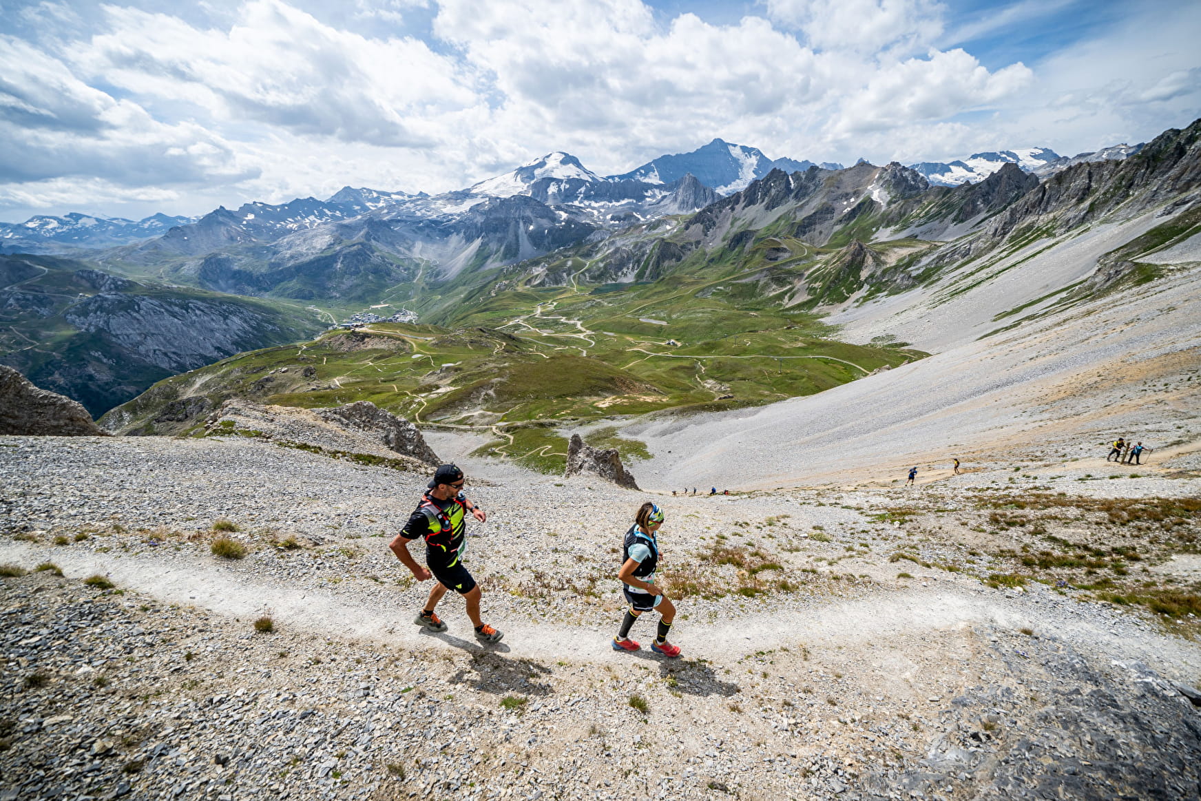
Are you used to ski right below the Aiguille Percée in winter? It's time to admire it in summer. Enjoy a steady climb up the ridges then a more winding descent down the slopes of Palafour.
About
1 3


1/ From Tignes le Lac, opposite the Maison de Tignes, take the path that goes up to the right at the foot of the Palafour chairlift
2/ At the intersection with the balcony path going down to Tignes 1800, continue on the 4x4 track
3/ After passing under the Chaudannes chairlift, leave the 4x4 track and turn left (path below the avalanche dike)
4/ Continue in the direction of the Aiguilles Rouges and climb to the left to reach the scree of the Aiguille Percée ridge
5/ Take a photo break at the orientation table then continue on your way. After the Aiguille Percée, go down to the left
6/ At the top of the Palafour chairlift, take the direction of the Chardonnet lakes then go back down to Tignes le Lac by the 4x4 track (left at the intersection)
Prices
Free access.
Reception
Dogs are not allowed in the Tignes - Champagny Nature Reserve
Period of practice
From 01/06 to 31/10.
Depending on the snow.
Contacts
Access


