Snowshoe route n°5: Chemin des Galapias
Departure from the Perrière residence.
Description: Take the road that leads to the summer leisure area, and take the path that crosses the entire leisure area, along the Agorespace. Take the path on the left, at the exit of the recreation area. This one descends slightly in the direction of Nanchenu. When you join the path that goes up on the slopes, take the bridge on the left that spans the Bellard torrent. The path turns left, skirting the artificial snow factory on the left and arrives at the hamlet of Nanchenu at the foot of the slopes. Alternatively, cross the slopes of the snow front as well as the hamlet of La Pierre, and access circuit n°7 following the map, La Pierre-Bon Mollard.
Return: Loop by the same route.
Alternative (Path n° 9): Once in the capital of St Colomban, possibility of taking the “Pierre Bozon” forest path, the start of which is located opposite the Remarkable Tree (next to the Town Hall). Continuing straight ahead, this path will take you to the hamlet of Les Roches. In order to reach La Perrière, go down again by taking the main road.
Note: Very “easy” family discovery walk, from one hamlet to another.
- Sport
Snowshoe route: The path of the Galapias
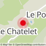
Map of walking and snowshoeing routes available for download on this page and from the Espace Glandon Tourist Office.
About
Prices
Free access.
Reception
Period of practice
From 02/12 to 14/05.
Subject to snow conditions.
Equipments
- Parking
Contacts
Access
