
After passing through the village and crossing the bridges over the Guiers and Cozon rivers, you'll embark on the winding "Buis" road, which offers an impressive view of the Frou gorges road and its cliffs. Departing from the road, you'll venture onto the signposted path that traverses the river, where you can savor the refreshing, pastoral scenery before continuing your journey.
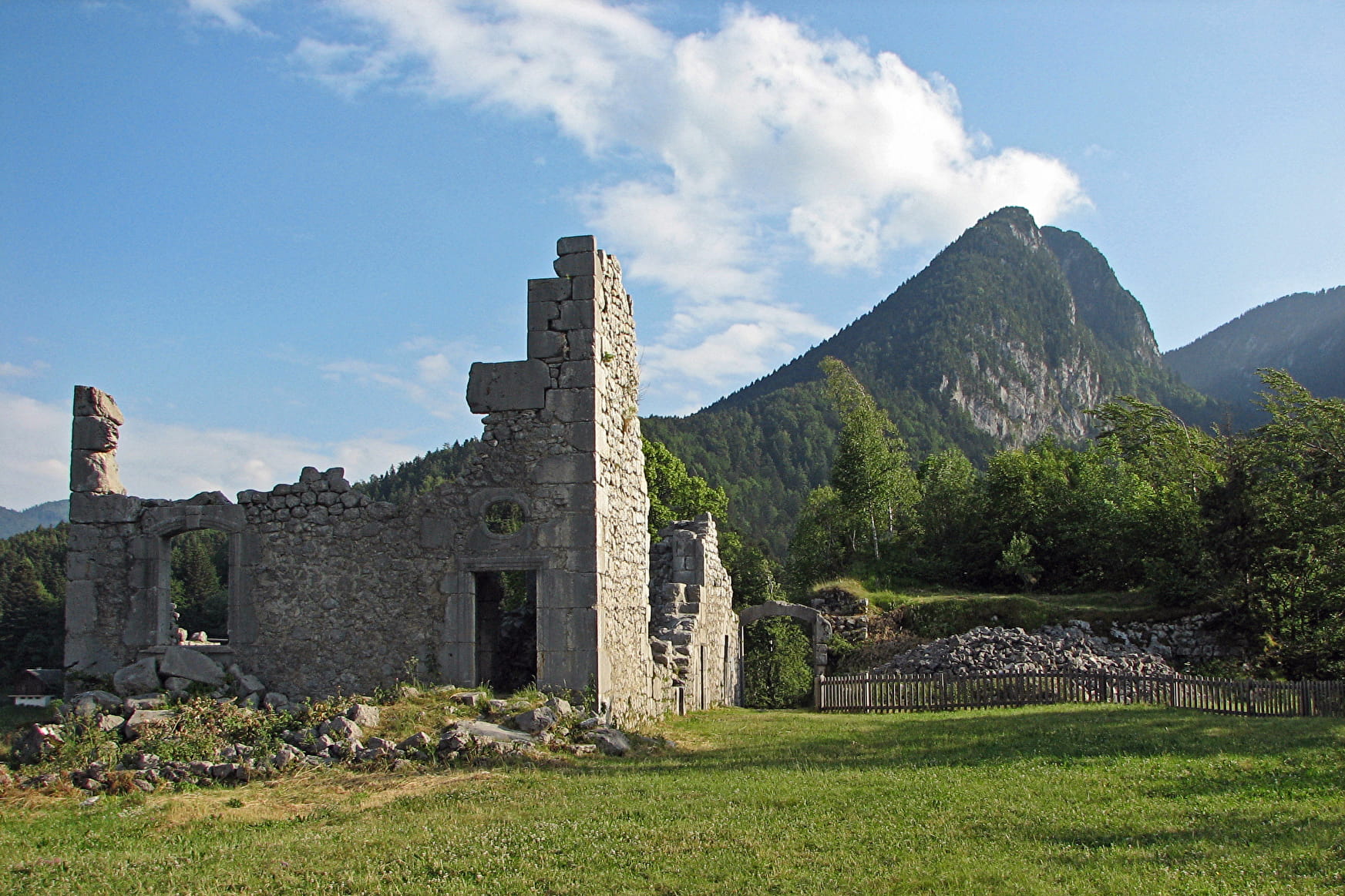
A beautiful forest ascent awaits you, promising a rewarding effort as you ascend towards the hamlet of Le Château. Here, you'll encounter the ruins of Château de Montbel on your left, once a stronghold of the Lords of Entremont, constructed in 1306 and left in ruins since the French Revolution. A magnificent stone orientation table provides the names of all the surrounding mountains, allowing you to admire the breathtaking panorama. Picnics and siestas are encouraged in the meadow surrounding the château.
Upon returning to the hamlet, you'll pass by the historic oven and pond, tracing the course of history alongside the bucket wheel of an old beating saw. As you depart from the hamlet, a descending path will lead you back to the road, guiding you towards the village.
- Sport
The Castle circuit - drawing circuit
A loop trail to discover the Montbel Castle and its stunning panorama. As a Randocroquis®, it also provides an introduction to sketching techniques. Leaflets available upon request at the tourist information center.
About

Signs
Departure signs are installed in the villages near the car parks and public areas. To follow your itinerary, poles are positioned at the intersections and identifiable by a sign displaying the name of the trail and its altitude. Between two poles, you will find marked signs painted along the way, indicating whether to continue on the path or not. Also, pay attention to small signs to guide you. We recommend having the "Promenades et randonnées en Chartreuse" map with you.
Further informations
Stone, Hard coating (tar, cement, flooring), Rock, Ground
The Randocroquis booklet is available from the Saint-Pierre-d'Entremont Tourist Office.
1/ From the Tourist Office, follow the Corbel signposted route (yellow sign at the corner of the Tourist Office). Continue along the road, crossing the point on the Guiers vif, then straight on to the St Alexis church in St Pierre d'Entremont Savoie. 2/ Cross the bridge opposite the church and turn left along the road (signposted Le Château). Continue along the road, passing the school on your right, a quarry further on your left, then at the last houses, at the crow's feet, take the road on the left below which descends to the Guiers vif river.
3/ At the Les Buis sign, leave the road and take the yellow signposted path on the left. At the footbridge, the first Randocroquis® table offers a drawing workshop. Continue up the path until you reach the main road. Cross the road (with care) and continue straight ahead. The path climbs through the forest to the hamlet of Le Château (this climb is not passable in snowy weather). 4/ At the hamlet, take the left-hand path leading to the Château de Montbel ruins. The site offers exceptional panoramic views over the Entremonts valley, Randocroquis® tables and a relief orientation table. Once back in the hamlet, take the road down past the oven and basin. Then follow the bucket wheel of an old beating saw. The signposting continues along the road to the hamlet of Terray. 5/ After the last houses, take the path on the left, which winds through forest and meadows. Follow the road down to the village.
Prices
Free access.
Reception
Period of practice
From 01/05 to 30/11.
Subject to favorable weather.
- Pets welcome