

There were three of them in Maurienne, and each post had its own name.
On this surprising walk, you'll come near the monolith, that iconic limestone
giant. Picture this: cabins positioned every 10 kilometres between Paris
and Venice. At the heart of this enchanting forest dotted with Scots pines,
imagine the exchanges of visual signals between Mollard Fleury in Sardières,
Courberon in Avrieux and Plan de l’Ours in Saint-André.
To get a better grasp of how this ingenious system worked, visit the other
two sites. Easily accessible, they're suitable for all ages. Want to find out
more about the fascinating local heritage and traditions? There are weekly
guided tours throughout the summer. A brochure is available at tourist offices.
- Sport
Roche Bleue - Télégraph Chappe
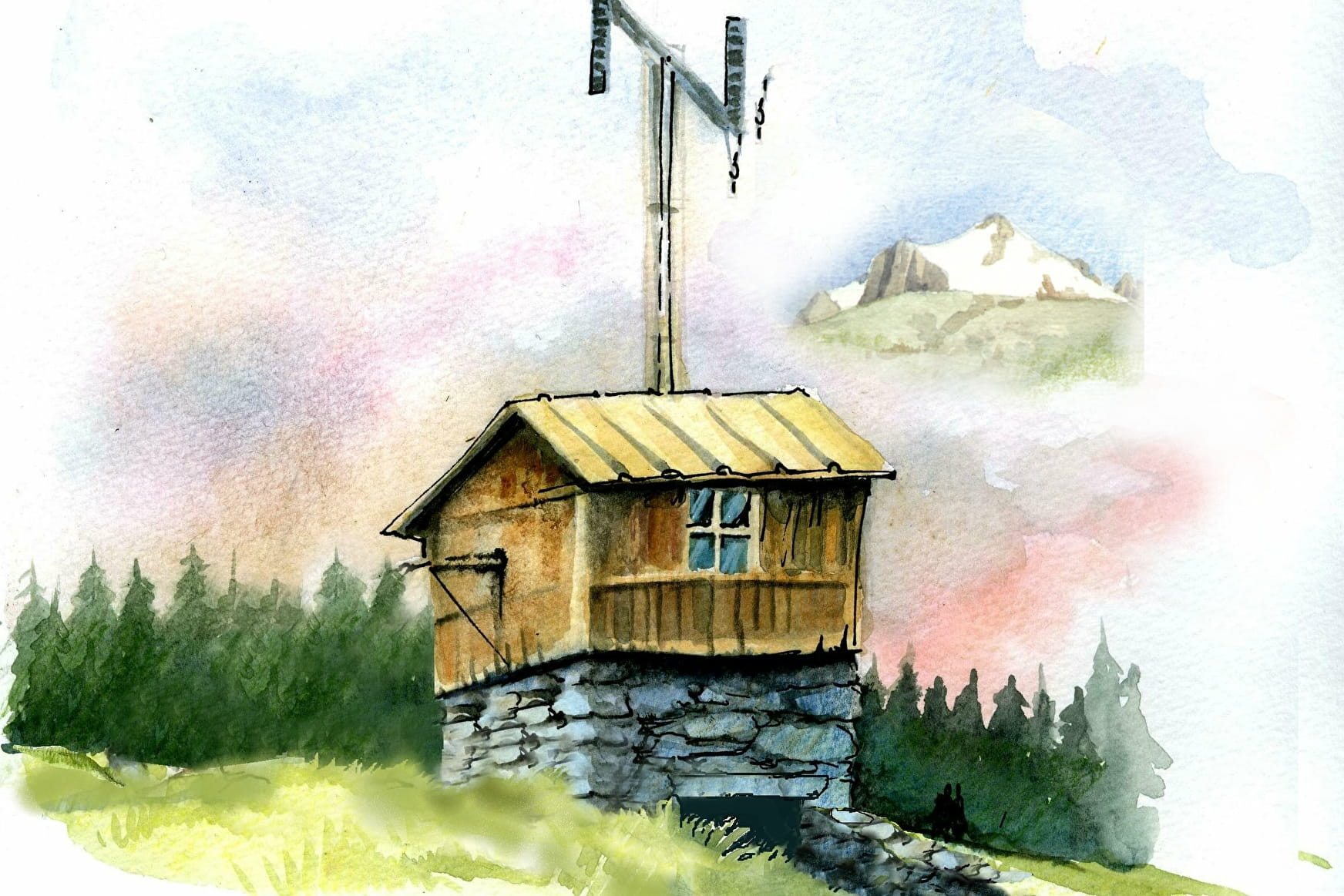
Go back to 1800 and follow the story of a pioneering telecommunications
marvel. How were messages circulated throughout Napoleon's Empire?
The ingenious Chappe telegraph network is a technical feat that's been
unearthed from the past.
Sport Roche Bleue - Télégraph Chappe Val-Cenis
About
Signs
Mixed marking (PR and PNV)
Map references
Map and booklet "Walks and Hikes Haute Maurienne Vanoise" (sold for € 10 at the Tourist Office)
Topoguides references
Blue route n°39
Further informations
Stone, Ground
1 1

To guide you in the field, consult the "step-by-step" directional diagram provided in pdf.
Prices
Free access.
Reception
Period of practice
From 15/05 to 15/10.
Subject to favorable snow and weather conditions.
Equipments
- Parking
Contacts
Access
By bus: Line S52 - stop Eglise.
By car: Park in the Val Cenis Sardières church parking lot.
