


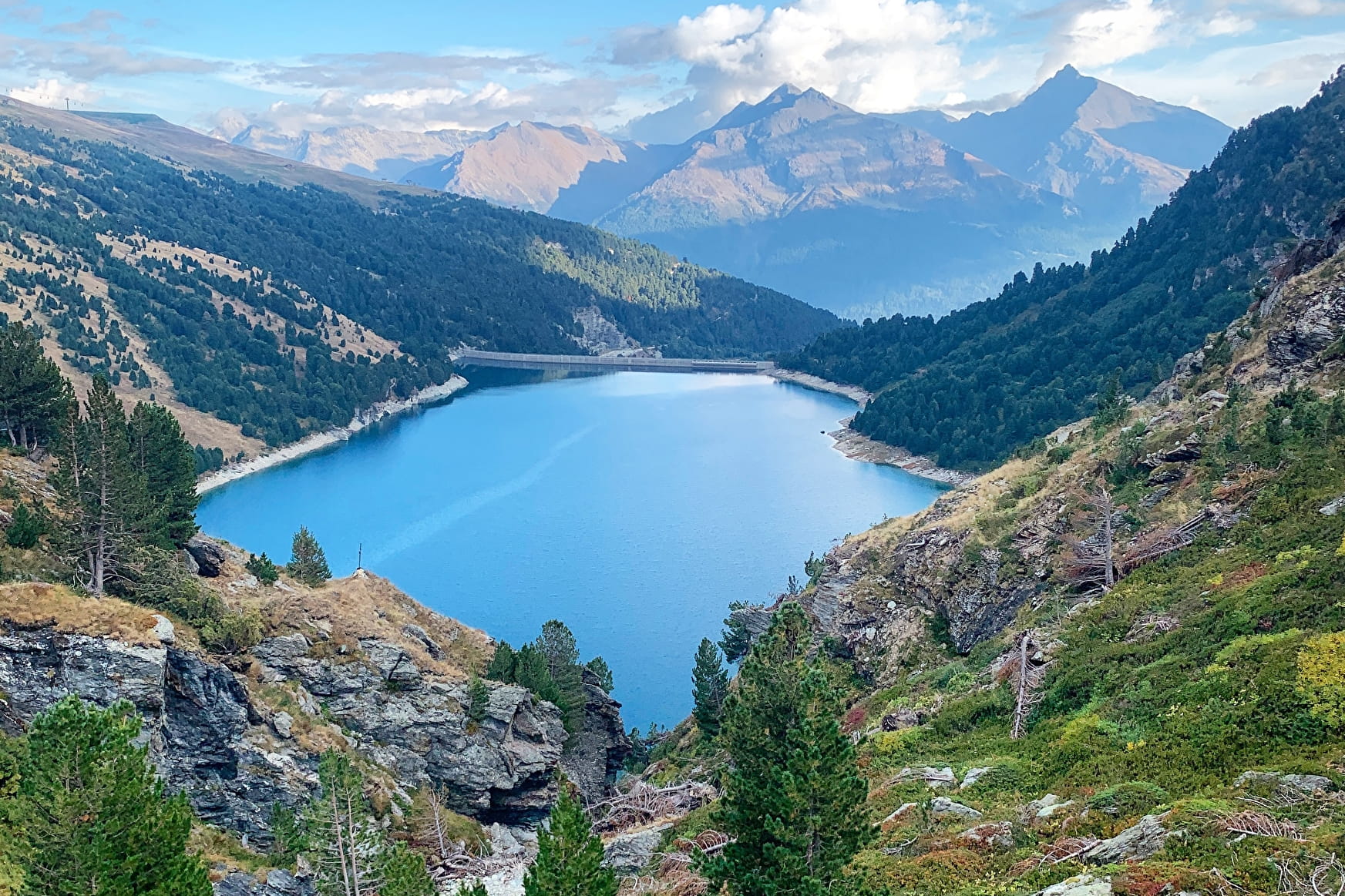
If you love views of landscapes dramatically falling away from you, then every
step of this hike will be a delight. The artificial lake, twinkling like a diamond
in its case, attracts your eyes every time you look up towards the horizon.
Whatever the season, the colours cast a magic spell. Even the marmots'
little cries of alarm won't take your attention from the satin-smooth surface.
This water basin in the high-altitude grasslands plays a crucial role in storing
water for the neighbouring valley. Like its downstream counterpart, Plan
d'Amont's hydroelectric dam is used, among other things, to power ONERA's
international wind tunnel, a flagship aerospace research project that tests
model aircraft and rockets.
At La Fournache refuge, take a rest as you imagine all those seasoned
mountaineers heading towards Pointe de Labby or Dent Parraché, majestically
rising up above you to a height of over 3,500 metres above sea level.
- Sport
Plan d'Amont Dam Circuit
Enjoy a walk along this terraced path, eyes drawn to the hypnotising colours
of the lake. Feel the serenity as you cross the sunny alpine pastures and
clearings. Hike right into the Vanoise National Park. You'll feel like you're
a million miles from home!
About
Signs
Mixed signposting (PR, PNV and GR)
Map references
Map IGN 3534OT - Les Trois Vallées
Topoguides references
Map and booklet "Haute Maurienne Vanoise. 115 walks and hikes - 35 trail routes. For all levels" (sold for €10 in Tourist Offices) - Itinéraire bleu n°30
Further informations
Stone, Rock, Ground
To guide you in the field, consult the "step-by-step" directional diagram provided in pdf.
Prices
Free access.
Reception
The duration of hiking trails is calculated using reference paces: 300 m/h ascent, 500 m/h descent and 4 km/h on the flat.
As hazards may occur at any time on the routes, the GPX tracks provided are not contractual. They are given for information only. Riders use them at their own risk, depending on their level of technological proficiency and their understanding of the terrain.
Period of practice
From 15/05 to 15/10.
Subject to favorable snow and weather conditions.
- Parking nearby
Contacts
Access
By car: park in the Carrière parking lot between the Plan d'Amont and Plan d'Aval lakes.