The hike begins in the center of the village of Bonnevaux. Head for Courbelanche, where a lovely panorama awaits you.
You will then reach Ouzon Derrière Derrière and the Plan Champ pass.
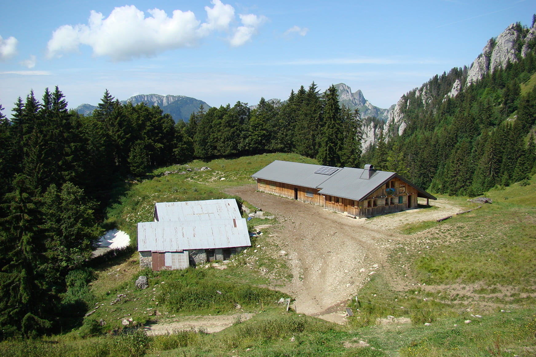
The descent takes you to the chalets d'Ouzon, where Abondance cheese is made, before reaching the Col du Corbier.
On the descent to Bonnevaux, you'll pass by the chapel of Notre Dame des 7 douleurs and the Alpage du Muret, a sheepfold that produces a variety of ewe's milk cheeses.
Alternatives: you can reach the summit of Mont Ouzon (duration: +1h15 ascent: + 230 m) and the summit of Sur Gémet (duration: + 30 min ascent: + 110 m).
- Sport
Mont Ouzon hiking trail
Starting from the village of Bonnevaux, a nice sporty hike that offers you a central panorama of the Chablais massif.
Sport Mont Ouzon hiking trail Bonnevaux
About

Signs
Departmental markings called P.D.I.P.R. on beige metal panel and green writing.
Difficult passages
The last 100 metres before reaching the summit are very steep.
Map references
TOP 25 N°3528 ET Morzine Massif du Chablais Les Portes du Soleil
Topoguides references
On sale in the tourist offices of the Abondance valley.
Further informations
Rock, Stone, Ground
1 3


1/ Car park of the Bonnevaux town hall
2/ Take the path that goes up towards Essert. When you arrive at Les Rez, cross the road and take the path that goes up on your left. You arrive on a wide flat track, turn right then at the next sign, follow the path which goes up on the left.
3/ Continue the ascent to Courbelanche.
The path goes back down towards Ouzon behind and then goes up towards the Col de Plan Champ.
Variation : there is a variation from the "Col de Planchamp" which allow you to go on the top.
4/ Start the descent towards the Chalets d'Ouzon. Once you have passed the chalets, continue towards the Col du Corbier, you will reach a small road which will lead you to the old resort of Drouzin le Mont.
5/ Go along the departmental road, past the artificial lake. Continue on the road until you reach the Chapelle Notre-Dame des 7 douleurs then take the path on your right. The descent is steep until you reach the road, which you walk up until you reach the Muret hairpin, from where you join the balcony path.
6/ Follow the path until it widens. At the intersection, take the path going down on the right towards Les Rez. Cross the road and continue down to Bonnevaux.
Prices
Free access.
Reception
Dogs must be kept on a lead because of the presence of herds.
Period of practice
From 01/06 to 20/11.
Accessible except during snow and depending on weather conditions.
Please check with the Tourist Office for the latest information on access conditions. This route is usually suitable for strong walkers during spring, summer, and autumn, except in adverse weather.
Subject to favorable weather.
Services
- Pets welcome
- Parking nearby
- Public WC
- Defibrillator
Contacts
Access
Departure from the car park's town hall


