


Little by little, you'll leave all signs of human presence behind on the first part of your hike. As you get to La Duis hamlet, you're greeted by a torrent that impishly weaves its way between rocks and pools. Having a rest here to cool off, you almost forget that the highlight still awaits you higher up, at 2,800 m of altitude.
Enter a land of contrasts, where alpine pastures and meadows merge with increasingly imposing scree slopes. The fireweeds are now behind you, and a well-marked trail ascends beyond the rocky outcrops. Here, chamois rule the land. Will they favour you with a royal visit? The closer you get to edge of the high mountains, the more the ridges seem to tear at the sky. You're there! This mountain cirque looks like an enchanted realm. This is where rivers are born. See if you can detect trickling water. As they say, the little streams make the big rivers...
- Sport
At the source oh the Arc River
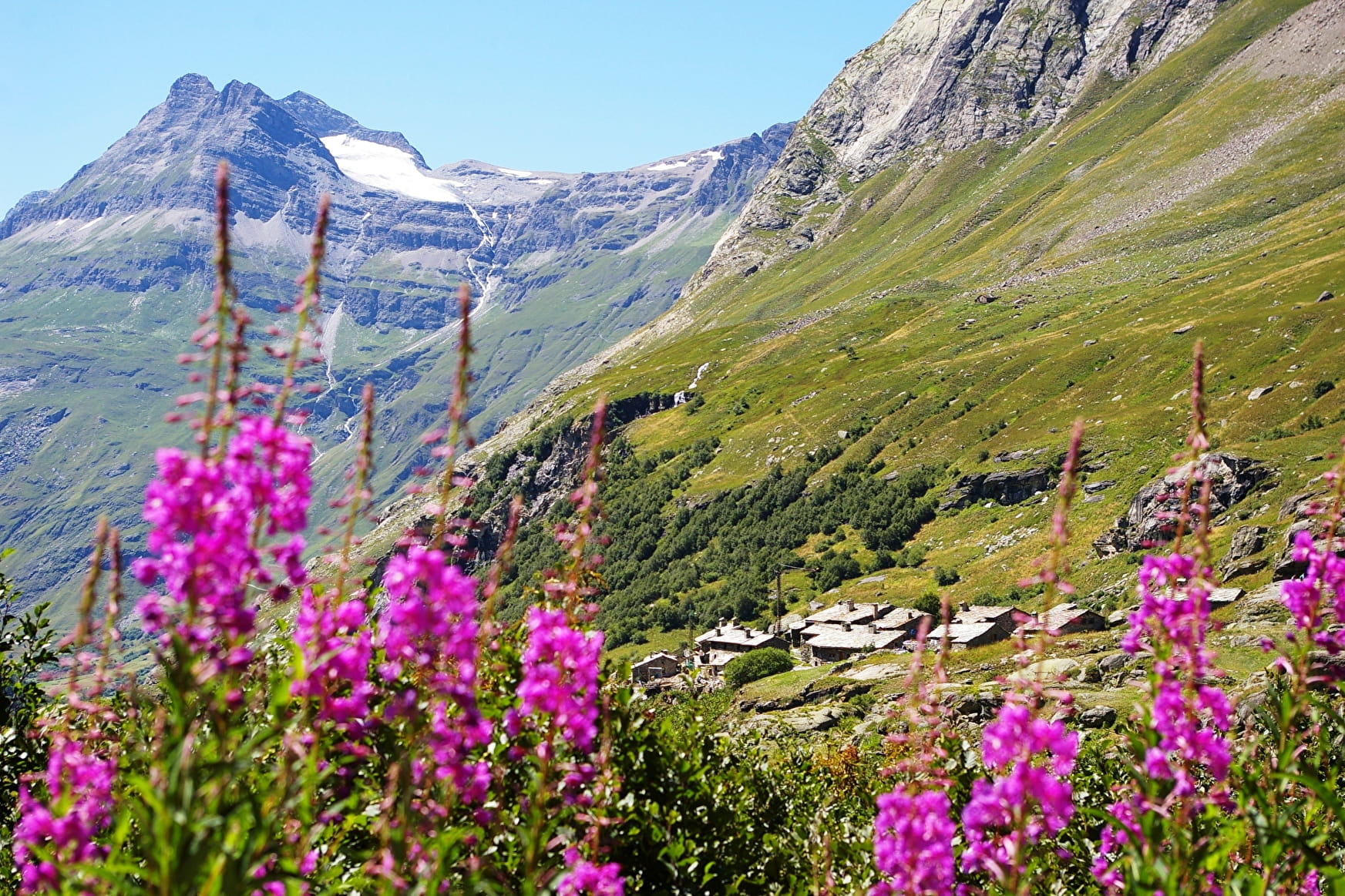
Discover an unspoilt paradise, where it feels like you've reached the "world's end". Make your way to the source of the iconic Arc torrent. Unfolding at the foot of the Franco-Italian Levanna glaciers, this hike is one of the most remote in Haute Maurienne Vanoise.
Sport At the source oh the Arc River Bonneval-sur-Arc
About
Signs
Mixed marking (PR and PNV)
Map references
Map and booklet "Haute Maurienne Vanoise. 103 walks and hikes - 38 trail trails. For all levels" (sold for €10 in Tourist Offices)
Topoguides references
Red route n°92
1 1

To guide you in the field, consult the "step-by-step" directional diagram provided in pdf.
Prices
Free access.
Reception
Period of practice
From 01/07 to 01/10.
Subject to favorable snow and weather conditions.
Equipments
- Parking
Contacts
Access
By bus: Line 7 - Parking de l'Ecot stop
By car: Park in the Hameau de l'Ecot parking lot (fee payable July-August).
