
From Parking P3, continue on the forest road towards the hamlet of Echaillon and continue to the classified hamlet "Le Monal". Cross the hamlet of Le Monal and continue straight ahead. Shortly after entering the forest, take a path on the left that winds up. At the first crossroads after the exit of the forest, turn right, join and turn left on the pastoral road that goes up from Chenal and follow it towards Le Clou. Then cross the Clou valley keeping the torrent on your left, the Balmes glaciers are on your right. Then, follow the small path going up to the Lac Noir along the torrent. Same itinerary for the return.
Please note that the Echaillon car park is not accessible by car. A free shuttle service runs from the Maisonnettes car park in the Sainte-Foy resort during the summer season.
- Sport
Hiking trail: the Lac noir
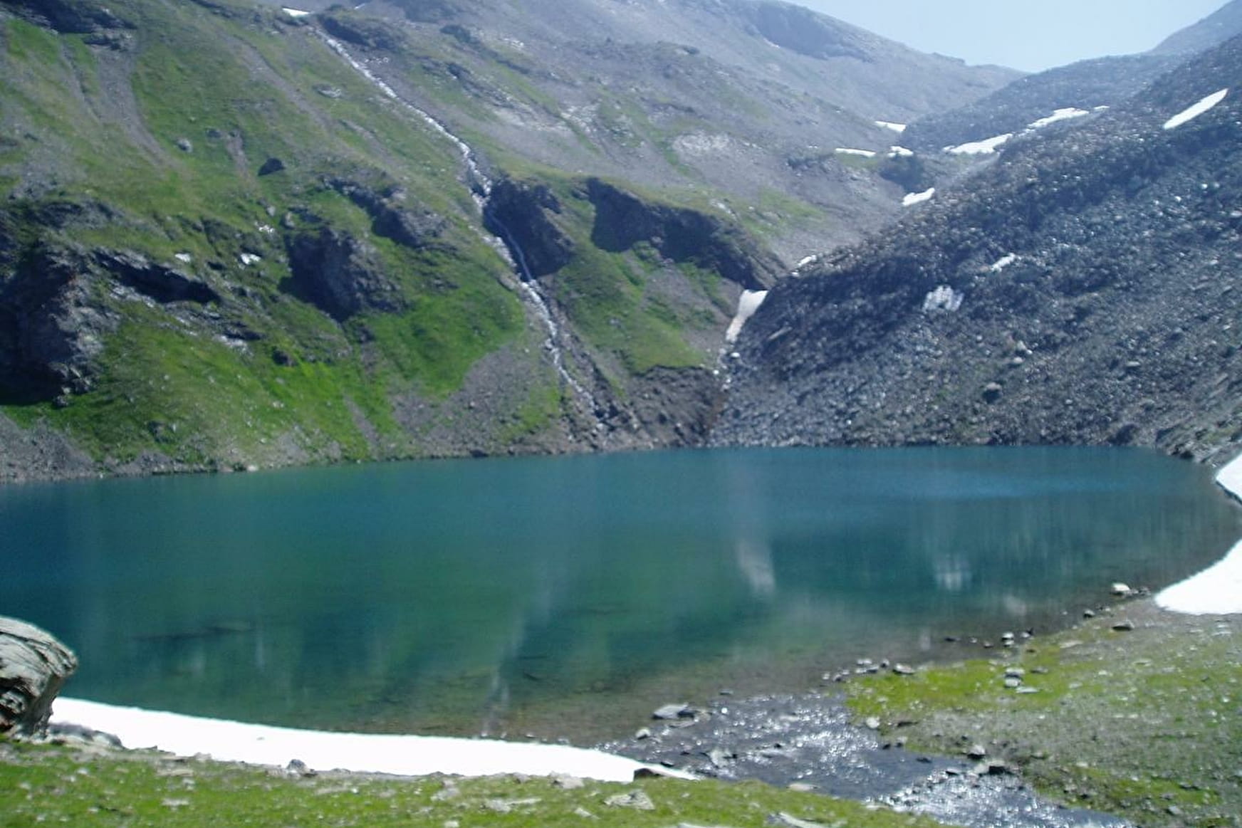
Cross the classified Clou valley and the Balmes mountain pastures to reach the Lac Noir, where beautiful views of the Balmes glaciers await you.
Map available at the Tourist Office of the resort.
Sport Hiking trail: the Lac noir Sainte-Foy-Tarentaise
About

Signs
Yellow markings
Further informations
Stone
Prices
Free access.
Reception
The car park is accessible from the Sainte Foy resort via a forest road.
Dogs must be kept on a leash due to the presence of herds.
Period of practice
From 01/04 to 30/11.
Subject to favorable snow and weather conditions.
Services
- Pets welcome
- Car park
- Free car park