Access: start from Parkig du Peray.
Follow the "Tête noire" sign, and climb for around 1h30 through the forest.
At the summit, you'll enjoy a magnificent view of the Aravis chain, including the Pointe Percée and the Têtes. You can extend the hike by going as far as Chalets des Bénés (+ 30 mins). Descend on the same path, following "le Peray".
- Sport
La Tête noire
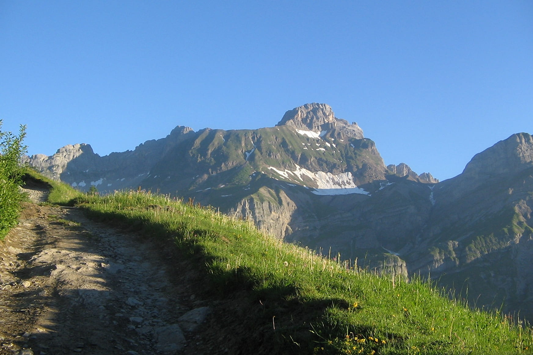
A small summit high above Cordon with a magnificent view of the Mont-Blanc massif and the Aravis range...
Sport La Tête noire Cordon
About

Signs
Beige and green departmental markings
Difficult passages
No
Map references
Map IGN 3430ET - LA CLUSAZ LE GRAND-BORNAND Les Belvédères du Mont-Blanc map on sale for €7 at the tourist office.
Further informations
Ground
1 2


Starting from the Peray (Perret) parking lot, most of the ascent is through undergrowth, and quite steady! At the summit, we skirt around the tête noire to reach the Cross, which is the highest point. We return by the same path, or by the long, winding Chemin des Ranges, which is taken at the foot of the Chalets des Bénés; at the bottom of the descent, we continue NNE, and up the hillside towards Les Sions. It's easy to reach the "des Bœufs" chalets, then the parking lot at the start.
The return journey can be made along the same path, or by taking the slightly rougher Chemin des Ranges, below the Chalets des Bénés, which allows you to return via a variant, and the Chemin des Sions.
Reception
Steep but relatively short climb.
On leash only, beware of pastures...
Period of practice
From 15/04 to 01/12.
Please enquire beforehand about the season, as this walk can be enjoyed all year round with suitable equipment...
Subject to snow conditions.
Services
- Pets welcome
Contacts
Access
From the village center, head for the right-hand slope, along the winding road to the terminus at the Mouilles parking lot (or the upper Perret parking lot, but the road is quite tricky).

