- Sport
Hike: The Postman's Route
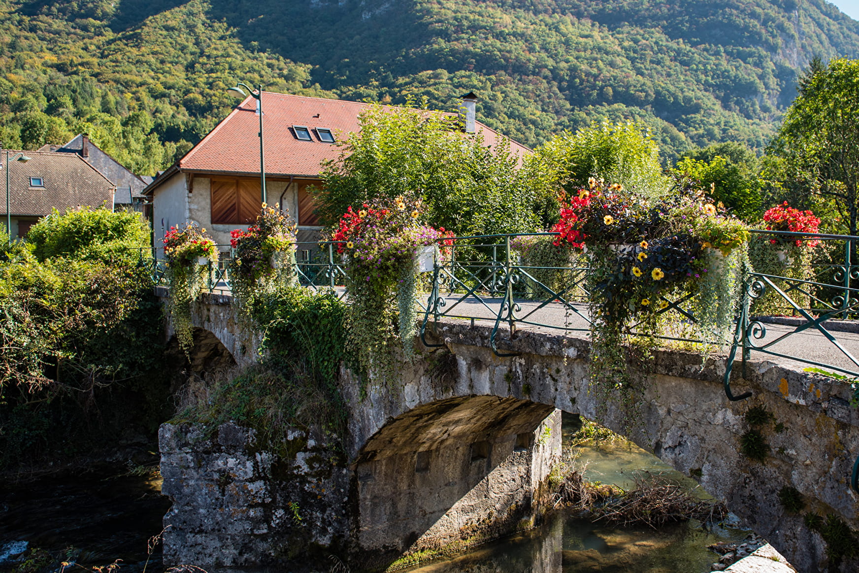
From the Carpark, follow the route du Pont Monnet for 150 metres. Then, cross the bridge on your right. Going up after la Serraz, you can see ruins from the Middle Ages. Head towards Giez Village where you will walk along the Golf Course.
About


1/ From the carpark, follow route du Pont Monnet for 150 metres.
2/ Then,cross the bridge on your right. Going up after la Serraz, you can see ruins from the Middle Ages. Head towards Giez village where you will walk
along the golf course. Via route de Végy and then after the practice, take
a left on the dirt path. Keep going on the bike path towards Faverges-
Seythenex, cross under the main road and leave the bike path to get
to Vesonne and the Villard hamlets.
3/ Up to Sollier, you’re walking along l’Eau Morte river. After that, cross the very pretty hamlet that is Verthier with its basins, its chapel, its houses and its authentic bridge. Cross RD 909A to go back onto the bike path towards Doussard (possible detour via route de la Vieille Église to see the lake via the nature reserve). You are then a few steps away from your starting point.
Prices
Free access.
Reception
Period of practice
All year round.
- Pets welcome
- Car park
- Picnic area

