


After passing Plan du Lac refuge, a real favourite for hikers, venture into a valley sculpted by the Leisse torrent. To the sound of whistling marmots, the glaciers of Vanoise appear tantalisingly close and yet distant. Make your way serenely aross the alpine meadow, where herds sometimes graze. Feast your eyes on the majestic peaks as you take a break at Saint-Barthélémy Chapel. Pointe de la Réchasse, Pointe Mattews and the prestigious Grande Casse stand guard with imposing authority. Nonetheless, Dent Parrachée and Dôme de Chasseforêt are not intimidated. As you cross the Rocheure riverbed, can you sense the magic of snow melting into torrents? Fierce in springtime, already calmer in summer... Though the glaciers are treating, the torrents keep flowing. Enjoy the tranquility of the mountain refuge for a food stop or a night at high altitude. In this seemingly endless valley, how far could you extend your journey? Tignes to the north, Pralognan la Vanoise to the west… Give in to a spot of daydreaming.
- Sport
The Refuge of Entre Deux Eaux
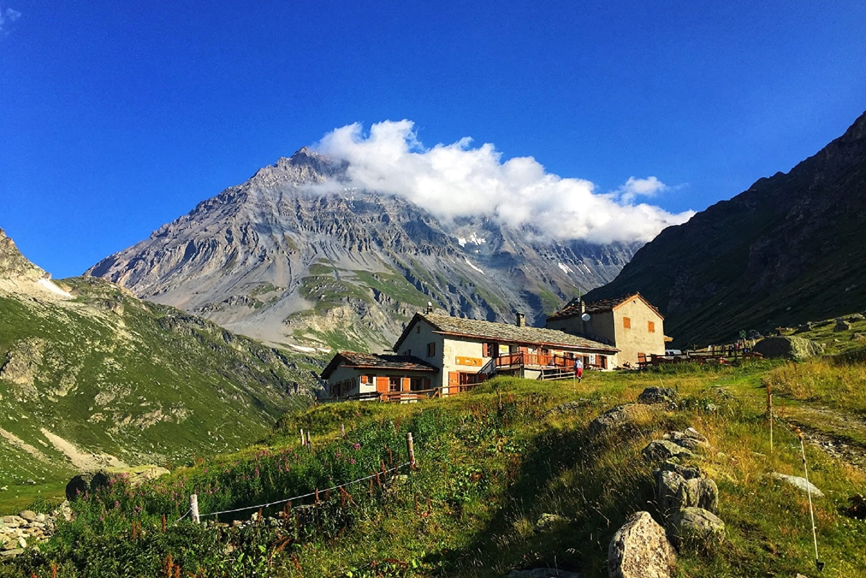
Do glaciers appeal to you? Nothing can quite match this adventure right at the heart of Vanoise National Park, in the magical high-mountain atmosphere. Step into the realm of the Leisse Valley. A whole new field of possibilities opens up to you.
Sport The Refuge of Entre Deux Eaux Val-Cenis
About
Signs
Vanoise National Park markers (PNV)
Map references
Map and booklet "Walks and Hikes Haute Maurienne Vanoise" (sold for € 10 at the Tourist Office)
Topoguides references
Orange route n°63
Further informations
Stone, Ground, Grit
To guide you in the field, consult the "step-by-step" directional diagram provided in pdf.
Prices
Free access.
Reception
Period of practice
From 15/06 to 15/10.
Subject to favorable snow and weather conditions.
Equipments
- Parking
Contacts
Access
By bus: Line 4 - Parking de Bellecombe stop
By bus: RD 126 from Termignon - Bellecombe parking lot (charge July-August).