This loop starts in the Valmorel station, at the Pierrafort cable car departure station (1,380m). Access is easy from car parks P4, P5 and the car parks in the hamlet of Crève-Coeur, or from the Télébourg intermediate station. To shorten the route, you can start from the top of the Pierrafort gondola (1,835m).
The beginning of the route follows the forest track which runs along the Morel torrent, then the path will be hidden in the undergrowth until Prariond (1,580m), chalet restaurant located at the foot of the ski lift of the same name, gateway to Pierrafort mountain pastures. Be careful, mountain bikes can cross pedestrians on the forest part.
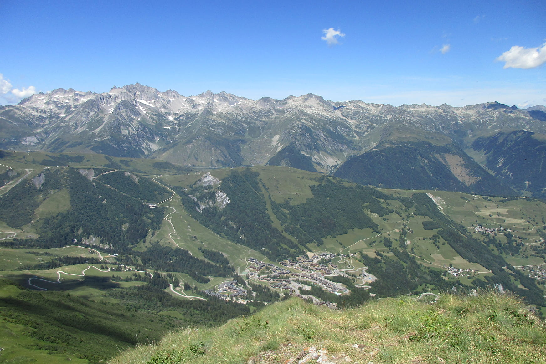
Once you have passed the chalet, the route winds through a mid-forest / mid-mountain environment. After a brief climb by stairs, the route takes a hillside path, reaching Plan Salin at 1,760m above sea level in the heart of a beautiful mountain pasture. You will have to take the direction of Pierrafort (arrival of the gondola at 1,835m) via a wide alpine slope, to then access the Col du Gollet (1,981m).
The final climb to the summit of Crève-Tête is sporty, with a steep section. At the summit (2,342m), a cross dominates a breathtaking landscape with a 360 ° view, undoubtedly one of the most beautiful panoramas in the French Alps: Mont-Blanc, Vanoise, Lauzière, Belleville valley, ...
The descent along the Crève-Tête ridge will allow you to admire all the surrounding peaks with a panoramic view facing Mont-Blanc. The path will then sink into the forest to reach the chalet of Pierre Larron, then that of the Bachals. Valmorel, final destination will then be in the crosshairs and will be reached after an alternation of pleasant undergrowth and clearings.
Environment: forest, high mountain pasture, snowfields.
Points of interest: 360 ° panorama, Mont-Blanc view, forest chalets, bachals, raptors.
Total distance: 15 Km
Elevation + total: 1,000 m (or 500 m if using ski lifts)
Estimated time: 7 to 8 hours (5 to 6 hours if mounted with the Pierrafort gondola).
- Sport
Boucle de Crève-Tête - B15
Savoie Mont Blanc's choice
Very nice route to discover the major summit overlooking the resort of Valmorel, the Pointe de Crève-Tête (2,342m) and its magnificent panorama.
Sport Boucle de Crève-Tête - B15 Valmorel
About

1 15


Prices
Free access.
Reception
Period of practice
From 01/06 to 31/10.
Services
- Pets welcome


