
From Flaine Forum / Bois Cartier / Les Langards: 1 hour
Enter the station and take the direction of the Forum (heart of the station). You will be able to discover the work of the architect Marcel BREUER there. At the Grandes Platières DMC cable car station N ° 28 take direction Poya N ° 29 then Balacha N ° 85. Then direction Bois Cartier N ° 94 and Essay N ° 95. There you will find a basin made of stone by alpagists of the time.
The Chalets d'Aujon test: 1 hour 10
After crossing the Lapiaz you will again find footpaths in addition to the skittles: Les Langards N ° 98, Le Grand grenier N ° 35, Plan des Chardons N ° 30, Les Chalets d'Aujon N ° 31, Aujon N ° 33 , Bois d'Aujon N ° 79, Le Stade N ° 55, Pré Michalet N ° 62, Flaine forum N ° 28.
Chalets d'Aujon to Flaine Forum: 50 minutes
The descent to Flaine is on the jeepable path in the forest which leads to the snow front.
- Sport
Aujon and its belvedere - Hike
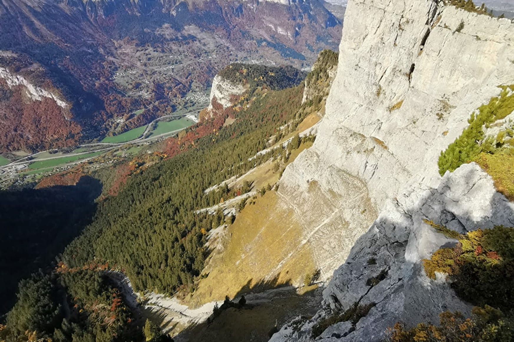
A hike that allows you to discover the landscapes of Flaine from another angle. After crossing the mountain pastures and some lapiaz, you can admire the panorama offered by the belvedere of Aujon.
Sport Aujon and its belvedere - Hike Flaine
About

Signs
Classic hiking signs and wooden skittles with numbers
Further informations
Rock, Stone, Ground, Grit
1 7


Prices
Free access. Guidebook on sale at the Tourist Office.
Reception
Keep your dog on a leash, he can scare off herds and wild animals.
Period of practice
From 15/06 to 13/09.
Subject to favorable snow and weather conditions.
Services
- Pets welcome


