1/ Head for the village of Chantel, go under the Transarc telecabin then head for the Blanche Murée forest and the le Rey shepherds’ hut,
downhill on Notre Dame des Vernettes crossing the Combe draglift.
2/ Head for Charmettoger, take the start of the Tour du Golf.
Take the Notre Dame des Vernettes track.
Moderately difficult walk, sometimes with progressive ascent, paths not too narrow.
- Sport
Arc 1800 to the Chapelle N.D. des Vernettes
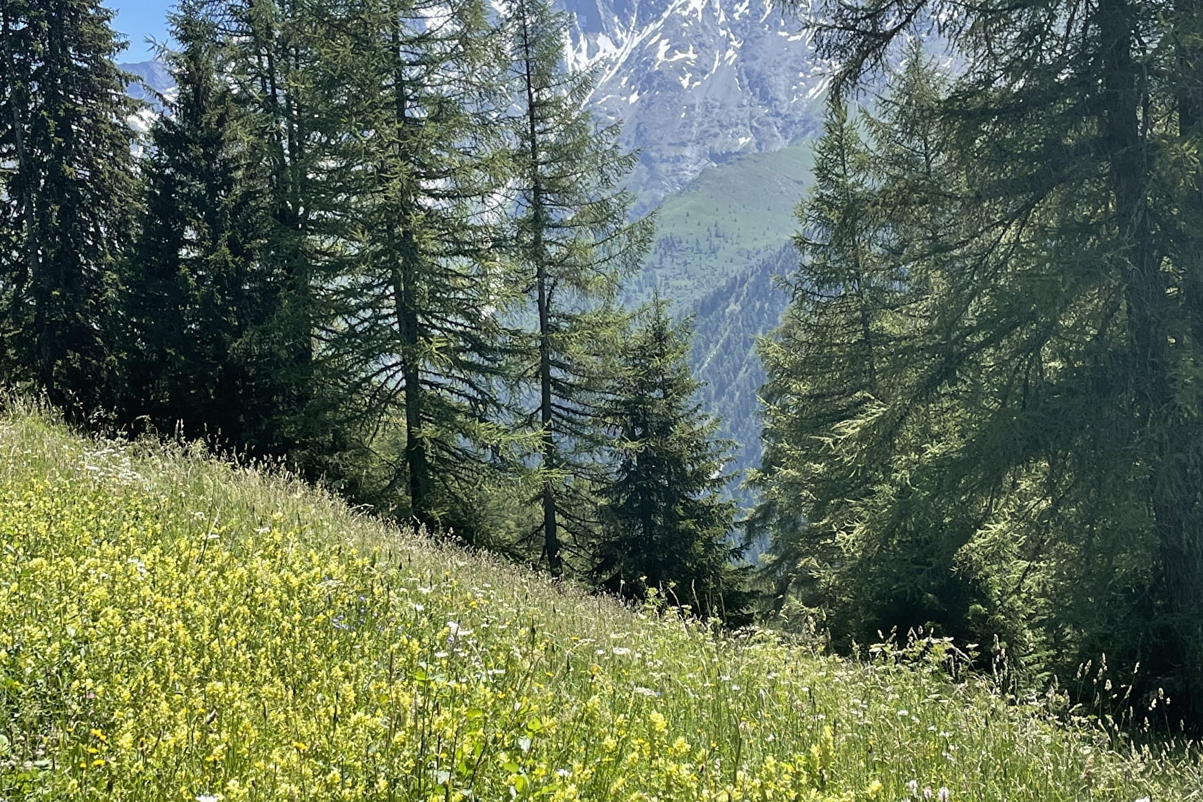
View over the Bellecôte chain and the les Lanches valley.
WARNING : Hunting season open from 10/09 to 28/01
Sport Arc 1800 to the Chapelle N.D. des Vernettes Les Arcs
About

Signs
Our summer tracks are marked with yellow signs. You can also find yellow rectangles painted on stones or ponds.
Map references
TOP 25 IGN 3532 ET
Topoguides references
Path n°28
Further informations
Ground
1 2


1/ Follow the village of Chantel, pass under the Transarc cable car then follow the Blanche Murée forest and the le Rey sheperd’s hut, descend to Notre Dame des Vernettes crossing the Combe ski draglift.
2/ follow Charmettoger, start the Tour du Golf. Take the path to Notre Dame des Vernettes.
Walk of medium difficulty, sometimes with gradual elevation, not very narrow paths.
Prices
Free access.
Reception
Period of practice
From 01/06 to 01/11.
Subject to favorable snow and weather conditions.
Services
- Pets welcome

