- Sport
Mountain biking route - The Salvagny Tour
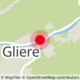
This tour, starting from the village of Sixt, crosses the vast plain of La Glière by a small road leading to Hauterive. From this plain, there is a remarkable view of the Tenneverge and, on the opposite side, of the impressive pillar formed by the Pointe de Sales.
About

Topoguides references
VTT X-Country n°65 - Circuit de Salvagny
From the tourist office go towards the school (characteristic new building) then turn in front of it to follow the small road leading to "Hauterive" then to the "Pont des Nants". Leave the bridge on your right and continue along the wide path. The path soon enters a spruce forest and then crosses a mountain stream which is often dry (but very tumultuous during storms or when the snow melts, as the width of its bed shows). A few metres further on, the route fords another mountain stream before undertaking a short but steep climb through a beautiful spruce forest. The path starts its way down along a wetland and then after a short climb meets the road to Salvagny. After passing through the beautiful village of Salvagny, follow this road back to the village of Sixt.
Prices
Free of charge.
Reception
Period of practice
From 01/05 to 31/10.
Depending on the snow cover.
- Repair kit
- Car park
- Free car park
- Public WC