You start off gently along a beautiful forest track to the Granges de Joigny. The easy part is already over! There's a tough descent to Grand Carroz, and then the climb kicks in! The path winds through the forest and then opens out onto splendid panoramic views. On one side you can see the whole of the Chambéry plain, with Lac du Bourget and the Bauges massif in the background, while on the other you can admire the whole of the Chartreuse massif. Chamechaude, at 2082 m, is watching you. In these conditions, it's difficult to look down, but be careful, as some of the passages are aerial. Descend to the pointe de la Gorgeat. Through the trees, you can still see Chambéry. Last ascent... You've reached Mont Joigny for a well-deserved break! At the foot of its little wooden cross, you can relax and admire the panoramic view.
After a steep descent (watch your knees!), take the same forest track as on the outward journey back to the car park and the Col du Granier hostel if you're feeling a little hungry!
- Sport
Pointe de la Gorgeat par les Crêtes de la Drière
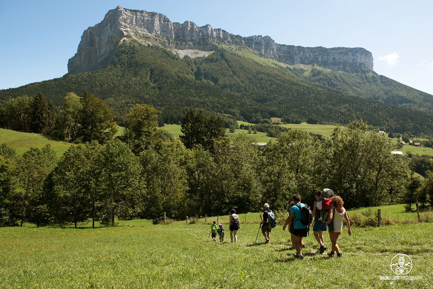
Varied path between mountain hamlets, meadows, crests and views over the Chartreuse and the Bauges mountains, and the Mont Blanc. Beware: aerial passages on the way. To ban if you are afraid of heights and when the weather is bad.
About


1/ From the Col du Granier, take the yellow trail opposite the restaurant towards the Granges de Joigny. The track alternates between meadows and undergrowth and joins the GRP de Chartreuse marked in yellow and red. 2/ After Les Granges de Joigny, at the edge of the forest, take the track on the left towards Grand Carroz. Cross a small ridge. The path continues north-west. After skirting a meadow, the path forks left and descends into the forest. Continue along a new meadow on the left. At the corner of the meadow, the path continues to the right. It then descends to a stream, which it crosses on a bridge. Climb back up to the hamlet of “Grand Carroz”. 3/ At the top of the hamlet, near the fountain, leave the GRP to the left. Go straight ahead on a yellow-marked path that climbs towards the Col des Fontanettes. Cross a meadow, then continue uphill through the forest. After a bend to the left, take the fork to the right. A few last hairpin bends lead to the Col des Fontanettes (1,330 m). 4/ From the pass, take the path to the right on the ridge towards “Pointe de la Gorgeat”.As you leave the forest, the view opens up to the north and Lac du Bourget.There are a few tricky sections that require vigilance for the rest of the route.After passing a few rocky steps, go around the summit of the Lentille to the right.The path then descends steeply to the edge of the precipice, which it skirts to the right. 5/ At the Col de la Drière, leave the path that descends to the right and climb back up, continuing along the ridge.After a few rocky steps, the path passes below the ridge through a steep passage and finally leads to the “Pointe de la Gorgeat”.6/ At the summit, take the GR96 (white and red markings) down to the “Col de la Gorgeat”, heading south-east. 7/ At the pass, continue straight ahead along the yellow-marked path towards “Mont Joigny”.The path skirts a rocky ridge on the right and leads to the summit, where a breathtaking view of the Chartreuse massif opens up. 8/ After crossing Mont Joigny, a narrow path descends steeply into the forest.At “Devant Joigny” (1,490 m), turn right towards “Les Ravines”.At the bottom of the descent, find the path to the Joigny barns.Turn left to reach the Col du Granier.
Prices
Free of charge.
Reception
Period of practice
From 01/05 to 30/11.
Subject to favorable weather.
- Pets welcome

