This plateau is an historic crossing point between France and Italy. Since it
was formerly a protected border, many military works have been built there.
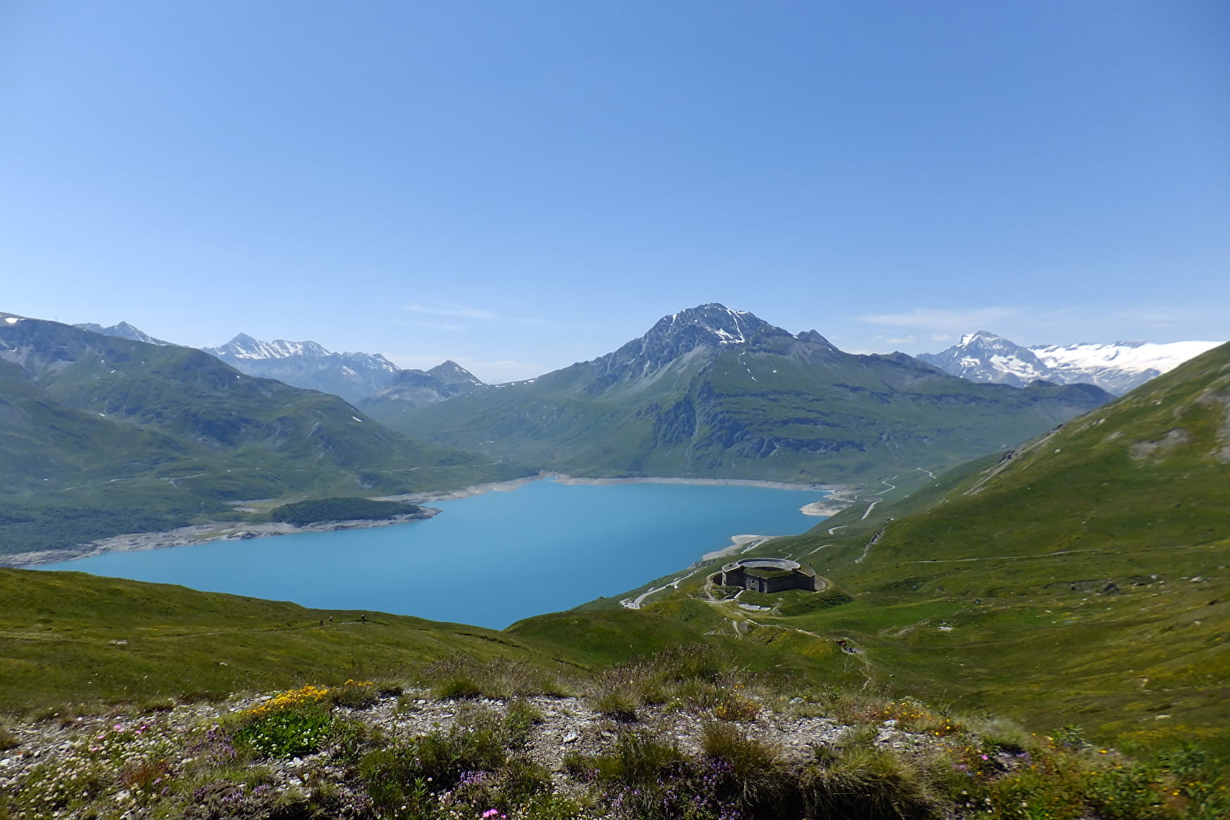
Fort Ronce is your first stop. The door is open, come on in and picture the
life of the Italian soldiers stationed here all year round, under the watchful
eye of the French soldiers stationed across the way! Like them, enjoy the
breathtaking view of the lake with turquoise waters and the glaciers of the
Vanoise.
Then continue your ascent on the gently sloping path to Clair lake, whose
waters are fed by glacial melt pouring in from the glaciers that overlook it.
The water's none too warm... Peace and quiet reign here, interrupted only
by the tinkling of cowbells and the whistling of the playful marmots. You'll
come across a few rock blocks scattered along the path, so take care as you
navigate through them.
As you turn back, towards the sun reflected on the distant waters of Mont Cenis
lake, a burst of colours greets your enchanted eyes: alpine flowers that only
grow at this altitude, such as violets, bluebell campanulas, and yellow trolles.
- Sport
Clair Lake
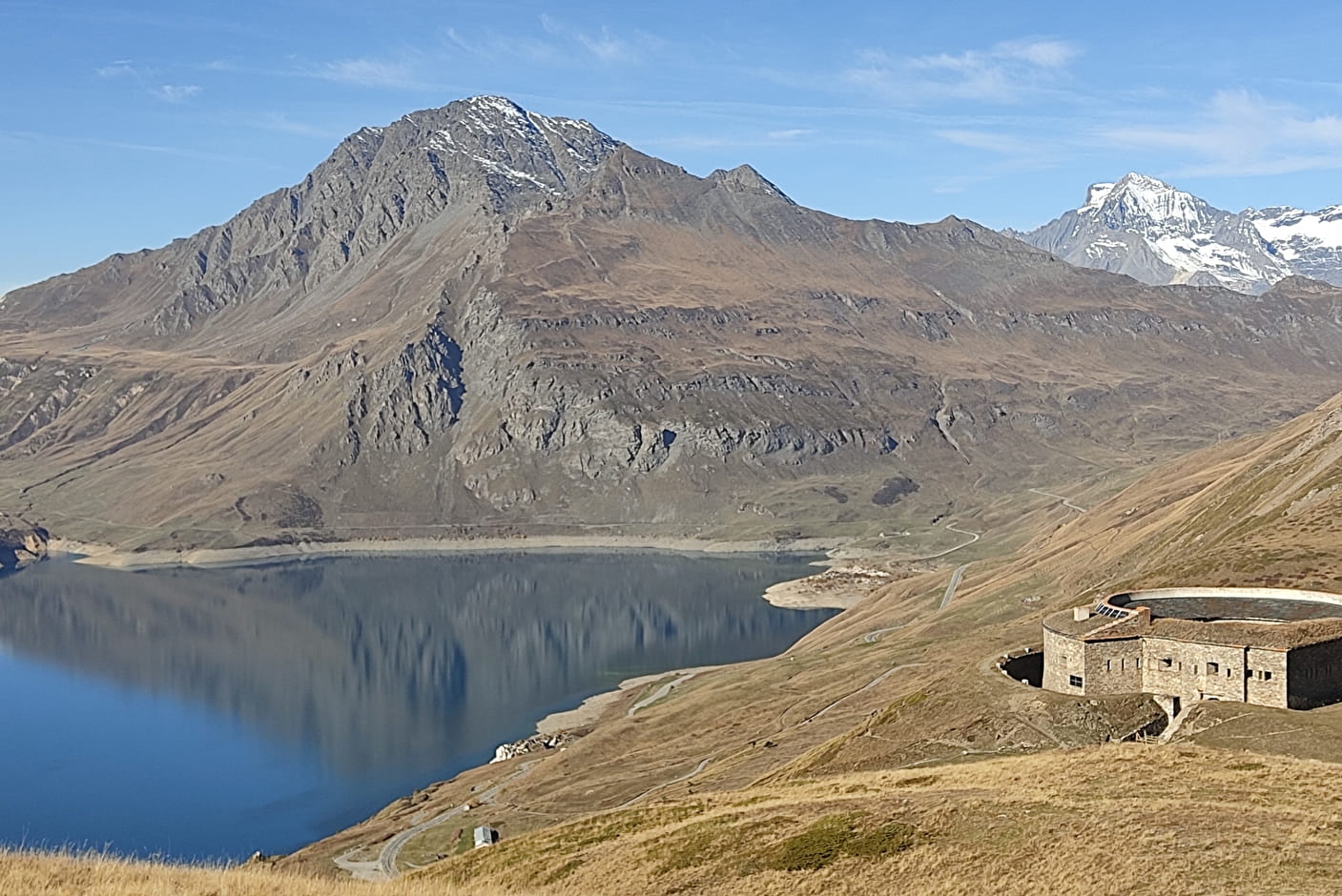
The Mont Cenis plateau is a place steeped in history, home to many forts,
including Fort Ronce, with its astonishing circular architecture. From this
watchtower, discover a breathtaking view of Lake Mont Cenis and the
surrounding peaks.
About
Signs
Departmental signposting (PR)
Map references
Map and booklet "Balades et Randonnées Haute Maurienne Vanoise" (sold for 10 € in the Tourist Office)
Topoguides references
Red route n°88
Further informations
Stone, Ground


To guide you in the field, consult the "step-by-step" directional diagram provided in pdf.
Prices
Free access.
Reception
Pets allowed on leash only.
Period of practice
From 15/06 to 15/10.
Subject to favorable snow and weather conditions.
- Pets welcome
- Restaurant
- Parking
- Public WC
- Picnic area
Contacts
Access
Getting there by car: At the Col du Mont-Cenis, park in the Plan des Fontainettes parking lot near the pyramid. The trail starts on the other side of the road.