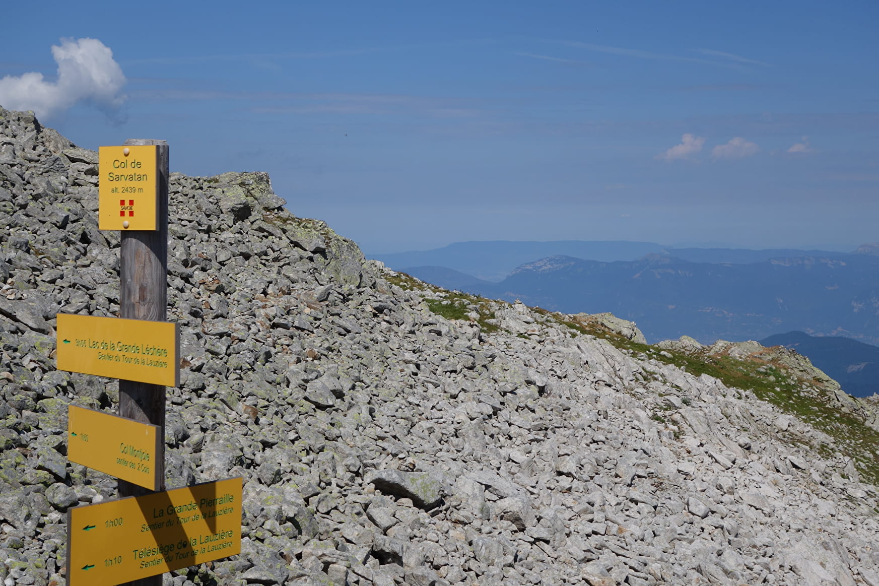
Starting point at the departure station of the Lauzière chairlift, pass under the lift. At the following intersection, let the «Col de Sarvatan» path on the right and take the one going down slightly on your left. At the «Grande Pierraille» intersection, go up on your right on the top of Crête Maxet. Go on straight ahead towards the Col de Montjoie. Take the track on the right to reach the Col Montjoie. At the Pierre Mouton intersection, go up on the right path towards the «Col de Sarvatan». The path leading to the mountain pass is narrow and steep. Be vigilant! Then, from the «Col de Sarvatann», go back towards the Lauzière chairlift, where you started from.
- Sport
The two mountain passes : Montjoie and Sarvatan (10)
[Saint-François-Longchamp area]
Black level (difficult) itinerary. 8,4km and 5:30 h long.
Sport The two mountain passes : Montjoie and Sarvatan (10) Saint François Longchamp
About

Prices
Free of charge.
Reception
Period of practice
From 01/07 to 31/08.
Services
- Pets welcome