MILITARY STRONGHOLDS
The mountains around La Rosière and the Petit St Bernard pass have witnessed several military battles. Because of its strategic cross-border position, the area’s first large forts were built here by the House of Savoy (an important European dynasty) to protect the area against the threat of French revolutionaries in 1793-1794.
Following the annexation of Savoy by France in 1860, the Italians were now the enemy. Towards the end of the 19th century, French soldiers started building and occupying the Fort de la Redoute, perched high upon the Traversette pass.
In the time between the two wars, the fortifications expanded as tensions grew. From June 1940 to the offensives in March and April 1945, shelters and protective measures were increased around the Petit St Bernard pass and along the crests of the surrounding mountains, particularly between the Roc Noir and the Fort de la Redoute.
In 1940, the Italian army launched a three-day attack on the border, and managed to break through along the top of the mountains. The Fort de la Redoute resisted all Italian offensives, but in the end the French were forced to sign an armistice and surrender their position to the enemy. The Italians occupied the region for three years until the Germans took their place. The Germans were finally ousted in an attack launched in March 1945, when the French army took the Roc Noir.
Today, the area still displays many scars from the occupation. Look carefully at the surrounding rocks and you will see messages engraved by soldiers during the long periods of observation and surveillance.
A word of warning: the fort should only be viewed from the outside. It is prohibited to go inside the ruins for safety reasons.
ITINEARARY
Buy a ticket for the chairlift from the lift operator then take the Roches Noires Express chairlift. Please ask at the Tourist Office or the Lift Pass Office for terms and conditions of use. The chairlift will take you from the bottom of the slopes up to the highest point in the La Rosière ski area. At the top of the chairlift, head left towards the Traversette pass and the ruins of the Fort de la Redoute. Follow the ski slope until you reach the Embrasures pass. Turn off the ski slope and follow the trail along the ridge of the mountain until you reach the Fort de la Redoute. Walk around the outside of the fort then take the slope down to the right, towards the Traversette pass, heading towards the Plan de l’Arc and Les Eucherts. Turn left off the slope onto the pathway. At the foot of the Fort chairlift, take the track which leads to the Plan de l’Arc. Continue through Les Eucherts village towards the centre of La Rosière. Go through the Place des Eucherts square then take the pathway through the forest. Once you get to the centre of La Rosière, continue up the road towards the Petit St Bernard pass and you will reach the bottom of the main chairlift in La Rosière.
- Sport
THE MONT-BLANC PANORAMIC TRAIL
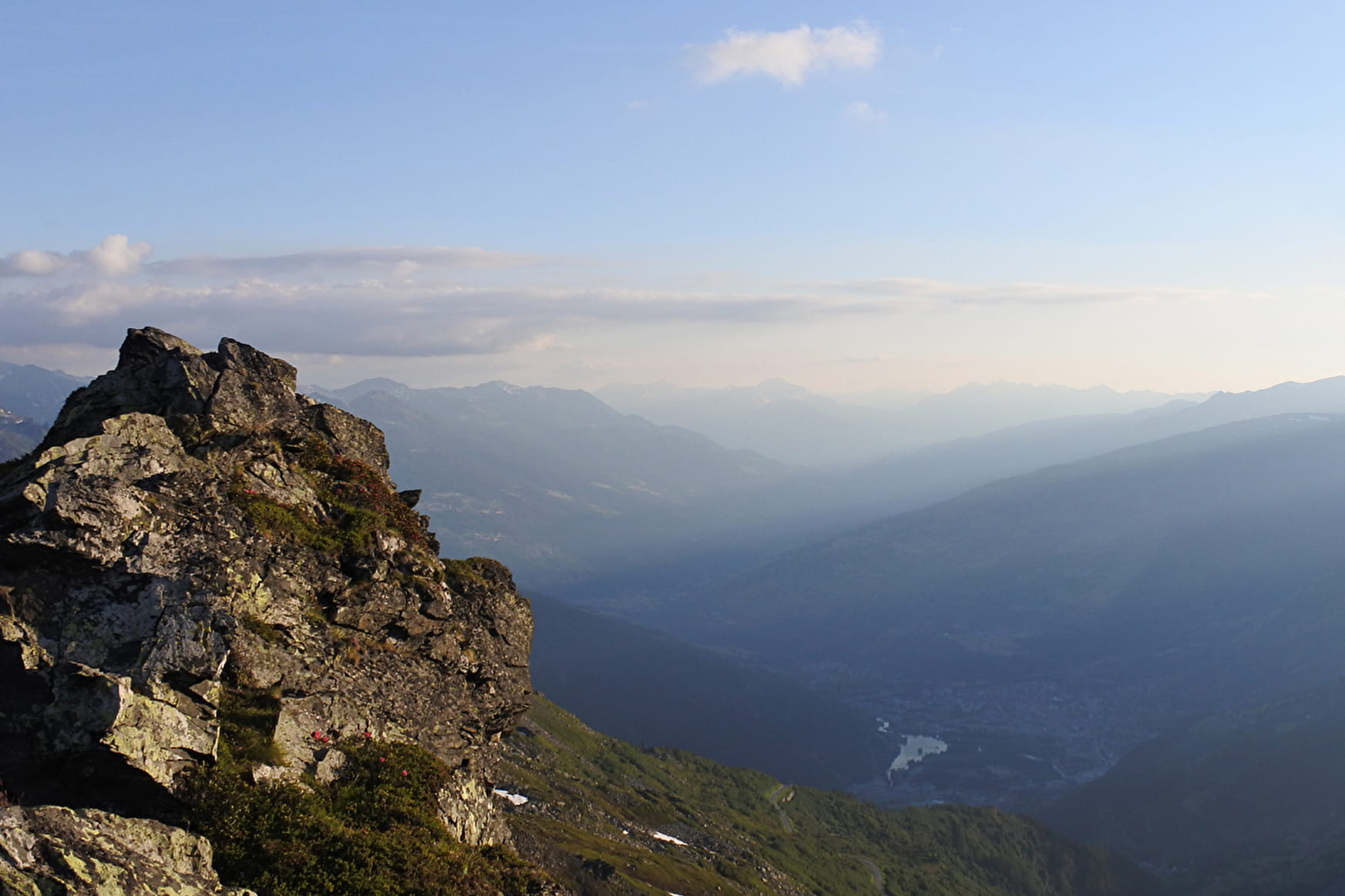
Examine the battle scars around the ruined Fort de la Redoute. Start: from the car park at the foot of the slopes in La Rosière centre, take the Roches Noires Express chairlift up the mountain. Easy.
Sport THE MONT-BLANC PANORAMIC TRAIL La Rosière - Montvalezan
About

1 2


Prices
Free of charge
Reception
Period of practice
From 07/01 to 10/31 : open daily.
Services
- Pets welcome
- Accessible via ski lift

