THE LAC DU RETOUR
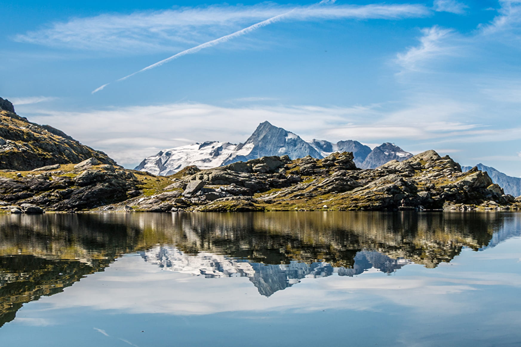
Like many high-altitude lakes, the Lac du Retour was formed in a basin hollowed out by the glaciers. Perched high in a glacial cirque at an altitude of 2,400m, the lake covers an area of around 2 hectares. The lake is almost 10m deep and sits on the rocky edge of this glacial amphitheatre. It is frozen for about 8 months of the year, and the ice only melts around the beginning of July. The harsh climate at such a high altitude makes it hard for living things to survive. The aquatic creatures that live in the lake only enjoy the sunshine for a very short period, and the frogs that live here take two years to reach adulthood. Brown trout and minnow can also be found in the lake: they are introduced every year by the local fishing society, but only the minnow manage to breed. Around the lake are wetlands, and if you look closely you can see some rare alpine vegetation. One of the most striking plants found here is cottongrass, or Eriophorum, whose flowers look like balls of cotton wool. This type of high-altitude habitat is very fragile - take care not to damage any of the area’s wild plants or flowers and, as always, show respect for nature.
ITINERARY
From Les Eucherts village, head towards Putétruit and Plan Pigeux. Go through the Plan de l’Arc and follow the track down until you get Putétruit, then turn left onto the path which passes above the chalets. Cross the bridge over the Torrent des Moulins. Climb up towards Plan Pigeux and go up the path on your left after the big cow shed. Turn immediately right and go up the steep winding path towards the Lac du Retour. At the Passage du Retour go straight on, and walk past the lake up to the Retour pass. Go across the pass and further down at the fork turn left. Walk around the mountain face under the tip of Les Couloureuses until you reach the Louïe Blanche passage. At the pass, go down the steep path towards the Combe des Moulins. Go past the “Pierre Gravée” (engraved stone). At the following junction, take the pathway down to your left. Go past the sign for the “Source Captée”. Head towards the bottom of the Fort chairlift and follow the track back to the Plan de l’Arc.
- Sport
THE LOUIE BLANCHE CIRCUIT VIA THE LAC DU RETOUR
A memorable hike that you will be eager to repeat! Start: Plan de l’Arc. Competent hikers.
Sport THE LOUIE BLANCHE CIRCUIT VIA THE LAC DU RETOUR La Rosière - Montvalezan
About
1 1

Reception
Services
- Pets welcome
