DEPARTURE: The Plan - Parking on the left after the chapel.
ROUTE: From the Plan, take the road briefly, go through LA CRÉPINIERE to join the PONT DU MOULIN. At the intersection of the ILES, turn left towards PLANET to join the TOURBIERE DU JAILLET (mountain trail with many roots). From there, a short round trip to the COL DU JAILLET can admire the Mont Blanc massif.
Go down to AU PLAN by LE CHAR, the ALPAGE of RAMADIEU and the CRÉPINIERE: beautiful points of view on the valley in the middle of the mountain pastures.
POINTS OF INTEREST:
- The panoramic view of the Mont Blanc massif.
- Characteristic landscapes of the territory: undergrowth, spruces and small alpine farms.
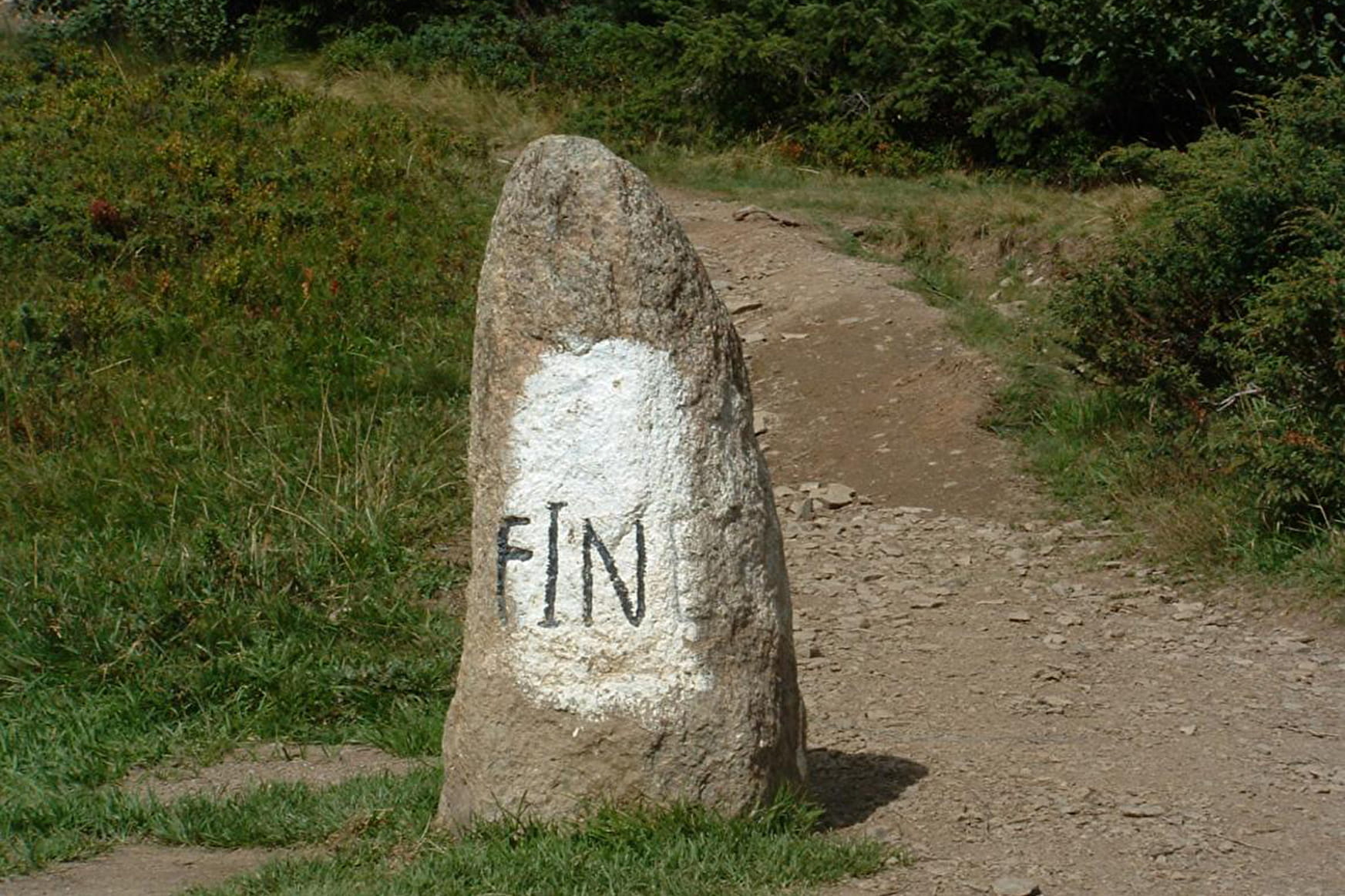
- Passing through the Jaillet Pass you can admire one of the only traces left by the Romans and discovered in 1963, a Roman milestone (dating between 125 and 14 BC) marked "FINES" (Latin border).
- Sport
The Col du Jaillet
Exceptional panorama on the Mont-Blanc massif.
Sport The Col du Jaillet La Giettaz
About

Signs
Marked with yellow signs.
Map references
Val d'Arly Walk and Hike map-guide on sale at €9.
Topoguides references
Topo Walks and Short Hikes on sale at €4 in Tourist Offices.
Prices
Walking and hiking map of the Val d'Arly for sale at 9 € or Topo Walks and Short hikes on sale at € 4 in the tourist offices
Methods of payment accepted : Check, Cash, Bank/credit card
Reception
Dogs must be on a leash.
Period of practice
From 01/06 to 30/09.
Services
- Pets welcome
Contacts
Access
Plan car park, on the left after the Chapel.