Go hiking safely!
Walking time is approximate and does not take into account break times.
The topo/step-by-step description guides you generally but does not replace a 1/25,000 hiking map or other topoguides available in our tourist office!
In Sallanches, our Office of Guides & Leaders also offers a wide choice of outings accompanied by mountain professionals providing you with complete expertise on the environment and alpine nature, inquire at the tourist office to register.
Whatever your hike, check the weather before you go. Remember to take cereal bars, sufficient water, sunglasses, sunscreen, a cap or hat, a small first aid kit, as well as clothing suitable for your outing in your backpack. depending on the season and the forecast weather.
- Sport
Hiking Trail: Le Pont de Bellecombe (Bellecombe Bridge)
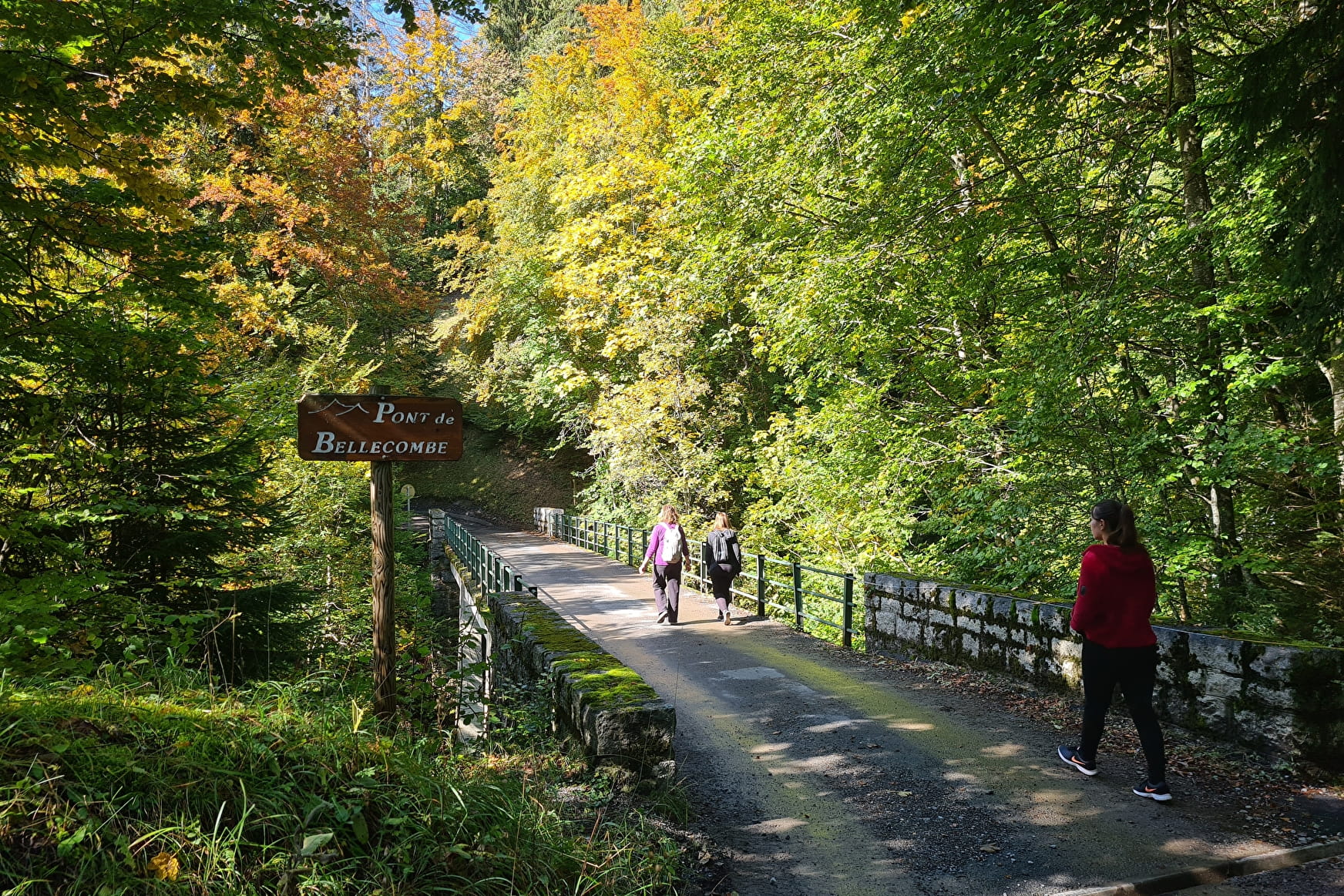
A short, quiet walk combining undergrowth and clearings with Mont-Blanc in the background. It's a special for beginners and for walkers in diapers!
On the course of many hikes in the Aravis massif.
About

Further informations
Groomed trail, Ground, Grit


Departure: Lintre - Phiterne car park
1.take the motorable path to the right of the car park
2. this path climbs slightly in the woods
3. at the fork, take the path on the left which is almost flat with a beautiful panorama of the Aravis, but also behind you on the Mont-Blanc Massif and the Fiz chain.
4. continue straight ahead, the path goes a little through the forest and spans a first small bridge, the Pont de Bellecombe, with a small torrent which is very invigorating at the end of winter.
5. Return by the same route.
Prices
Free access.
Reception
Go hiking safely!
Walking time is approximate and does not take into account break times.
The topo/step-by-step description guides you generally but does not replace a 1/25,000 hiking map or other topoguides available in our tourist office!
In Sallanches, our Office of Guides & Leaders also offers a wide choice of outings accompanied by mountain professionals providing you with complete expertise on the environment and alpine nature, inquire at the tourist office to register.
Whatever your hike, check the weather before you go. Remember to take cereal bars, sufficient water, sunglasses, sunscreen, a cap or hat, a small first aid kit, as well as clothing suitable for your outing in your backpack. depending on the season and the forecast weather.
Period of practice
From 01/04 to 15/11.
- Pets welcome
- Car park
- Free car park


