Track n°2 - BLUE
27.5km D+/- : 250m
From the Carré des Tisserands carpark, take Route d’Albertville towards “centre ville” (town centre). Take the 1st right onto Rue de la Gare and ride until it intersects the bike path, turn left here – or take a short detour to visit the Viuz-Faverges Archeological Museum, in this case continue straight ahead on Route de Thônes and then left on Route de Viuz - Follow this road until you reach Mercier then turn left to cross the forest of Mercier plains. At the exit “Sous les Murets” keep straight to join up with Route de Vesonne, continue riding on D42 road, cross Nant de Montmin creek – a very popular spot for canyoning among local guides and whitewater enthusiasts – then turn left onto Chemin de la Forge, and then right onto chemin du Pré de l’Ile, which descends to the small hamlet “le Villard”. Turn right, and take a path called Rochafaux, which rides along Nant de Montmin creek and then l'Eau Morte river to the hamlet of Verthier. Take time to marvel at the washhouse, the old chapel, and Blain house … – Take Route du Vieux Pont, cross Route de Talloires and continue on Route de Vieille Eglise – the entrance to the Bout du Lac d’Annecy Nature Reserve – until you reach D1508 road. Cross this main road at Pont Monnet bridge, then turn right onto the bike path, which you take to Lathuile (les Marais) – at Bout du Lac’s tennis courts cross back over D1508 road for a nice break at Doussard beach – Return to the bike path, turn left, and then head into the marshy area on the right-hand side. The trail follows the Ruisseau de la Bornette stream. When you exit the marsh, take another left, cross Bout du Lac road, and then turn right onto a narrow paved road that ascends towards Marceau along the Ruisseau de la Bornette stream. Visit the communal oven and fountain. When you leave the hamlet, turn right onto the 1st drivable road, and then take the GR96 trail to Arnand where a nice bridge allows you to cross the Ire River. Take the road heading downhill and then turn right onto route des Côtes until you reach the intersection with Chemin de la Serraz, turn right here. Next, pass through the small Z.A. des Vernays business park. The path continues through the forest, slightly uphill, and then downhill to Giez golf course, which you cross (Chemin de Rosaz). Take a short detour to visit the church and Ferme de Gy farm to enjoy the view of Mont Blanc. Turn left onto Route de Saint Gingolph, continue straight on Route de Rovagny, and then descend through the clearing to D142 road, which takes you to the hamlet called Englannaz. Ride across the hamlet until you reach D2508 road, and then take the bridge that crosses over the Glière river; turn right to enter Parc des Pins, then ride alongside the stadium and the protection wall. When you reach the “boulodrome” (petanque courts), turn left towards “centre ville” (town centre); take Rue Nicolas Blanc back to your starting point or ride up to Faverges Castle.
- Sport
Mountain bike route: along the sources of lake d'Annecy
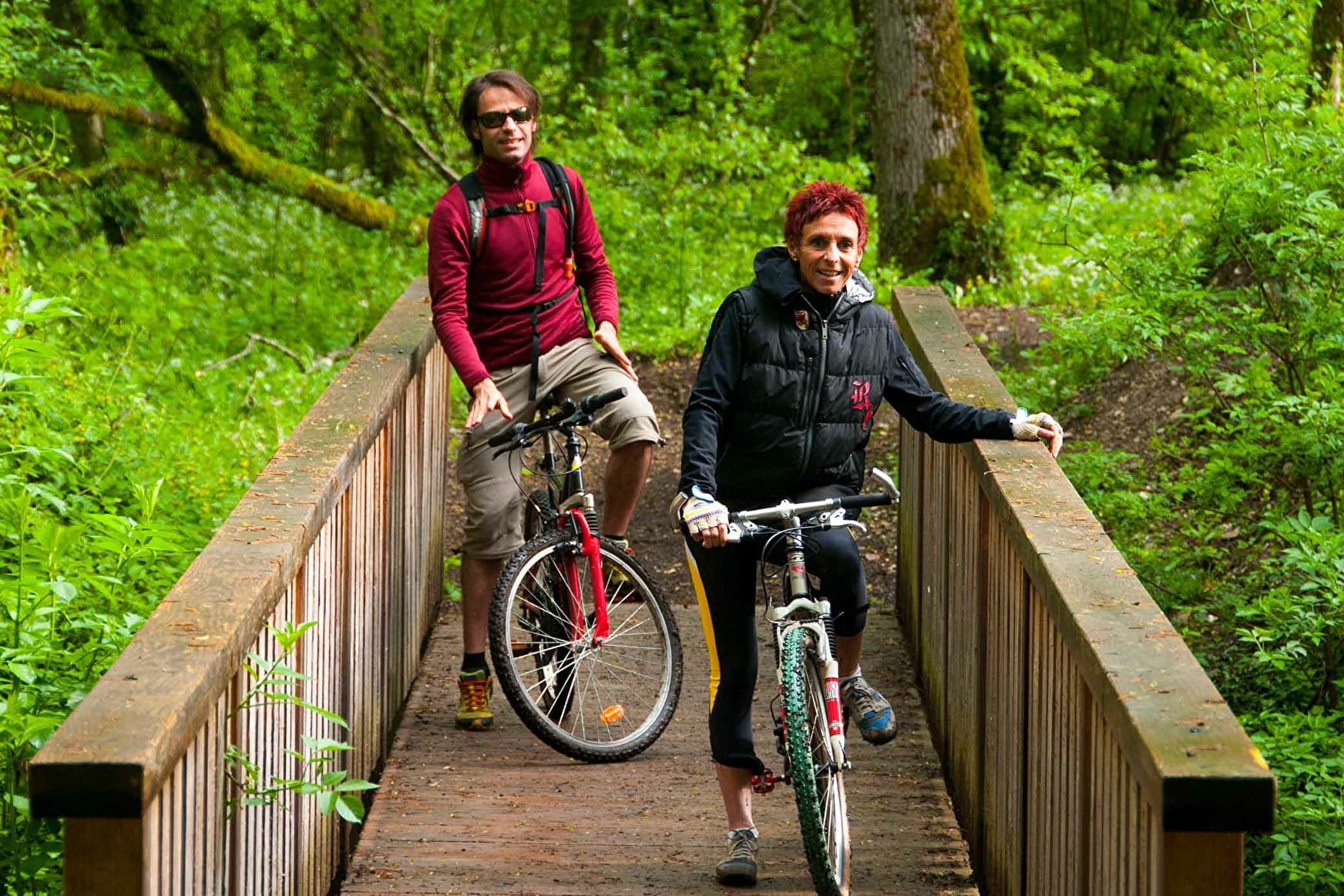
2h30 ride between Faverges and Doussard along the rivers that
flow into Lake Annecy. Start: Tisserands carpark in Faverges for a 27.5km long path with height differences of +200m and -200m.
Sport Mountain bike route: along the sources of lake d'Annecy Faverges-Seythenex
About

Further informations
Stone, Ground, Hard coating (tar, cement, flooring), Grit
1 1

Prices
Free access. 5 mountain bike routes kit to purchase for 3€ in the Faverges and Doussard Tourist Offices.
Methods of payment accepted : Check, Cash
Reception
Period of practice
All year round.
Subject to snow conditions.