From the Lac Bleu in Morillon, follow the banks of the Giffre river and cross the "Etelley" wood to reach the narrow footbridge of "La R'Biolle" (km 2.35), on your left, in the direction of the Lacs aux Dames in Samoëns. You pass alongside the Lacs aux Dames and the Giffre, then cross the Clévieux to reach the Vallon plain. A very good path crosses the plain and you soon reach the "Perret" bridge (km 6.92). Cross the bridge and turn left onto a pleasant path that leads through the village of Les Faix, past the chapel of Notre Dame des Grâces and on to the footbridge of Bas des Tines (km 8.30). After crossing the footbridge, you return to the road on a steep path, passing by the footbridge of Les Tines before going back down to the old railway bridge that once linked Annemasse to Sixt (km 9.03). Cross the bridge and you'll find yourself in a quarry. Once past the quarry, you continue along the Giffre and are not far from the village. The path gradually becomes a tarmac road and you pass through the village alongside the Giffre. You soon come to the "Curtets" footbridge. Take this footbridge and then follow the road for 400 metres before crossing the Giffre once again by the "Saugy" footbridge. Further on, the path becomes narrower and you cross a section with some technical difficulties. Be careful not to leave the path or ride through the meadows.
You then arrive above the village of "Brairet" (km 12.14), and the path, on the edge of the forest, quickly reaches the "nant du Dard" (a mountain stream, the waters of which are channelled by large embankments built of boulders). You then cross a vast clearing facing the villages of Molliet and Nambride before reaching the Pelly campsite on a path running alongside the Giffre and through a forest. You walk alongside the campsite before crossing the "nant des Pères" and then the "nant des Joathons" by the bridge at the entrance to the Cirque du Fer-à-Cheval cirque.
- Sport
Mountain biking route - Morillon > le Fer-à-Cheval
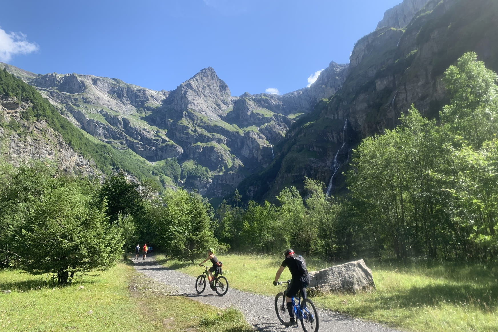
If there's one itinerary you really shouldn't miss, it's this one. The Cirque du Fer à Cheval is a splendid amphitheatre of rock cliffs, some over 1,900 metres high, with numerous waterfalls.
About

Topoguides references
VTT X-Country n°62 - Morillon > Fer-à-Cheval
Prices
Free of charge.
Reception
Period of practice
From 01/05 to 31/10.
Depending on the snow cover.
Equipments
- Car park
- Free car park
- Public WC