Sometimes set up to be fun or old, the route is a playground! Whether you are a beginner or a seasoned endurist! The departure from the Mont Cenis pass or from the Val Cenis ski lifts offers a plunging view of the valley and the surrounding mountains. The trail is easy and winds through an alpine pasture, the continuation in the forest will require a little more attention. You will certainly be more inclined to focus on the pleasure of driving!
28- Enduro - Red - A La Ramasse

There is no reason for you to be at La Ramasse on this route which is a small digest of easy DH and mountain trails
28- Enduro - Red - A La Ramasse Val-Cenis
About

Signs
French Cycling Federation markup
Map references
MTB Map Haute Maurienne Vanoise sold in the Tourist Office
Topoguides references
MTB Booklet Haute Maurienne Vanoise sold in the Tourist Office
Further informations
Stone, Ground, Grit
Prices
Free access.
Period of practice
From 15/06 to 01/10.
Subject to favorable snow and weather conditions.
Contacts
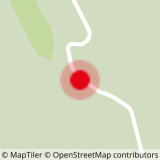
Access
The official start is at the Col du Mont Cenis
However, a departure is possible from the Val Cenis ski lifts in summer (July and August):
- Lanslevillard: this option saves you a crossing of about 3.8 km on the piste.
- Termignon: you will have to cross on a track of about 6 km; this adds 150 of D+ and 160 of D-.
In the summer season, you can take the bus line S53 (Modane - Bonneval/Arc) to get to the ski lifts, stop "Télécabine du Vieux Moulin" for the departure from Lanslevillard and stop "Maison de la Vanoise / Mairie" for Termignon. Bus equipped with a bicycle trailer every day except Saturday.