The trail starts at the end of the Petit-Châtel road, at the Tenne bend. From here it climbs gently up the mountainside through the forest. After 2 bends, the path reaches the link between the Petit-Châtel and Barbossine chairlifts.
Bottom loop option :
Go straight on, towards Flammet (Chalet de Théo), and then descend to the left towards the village.
More experienced hikers can complete the route with a more difficult variant, the Up loop:
At the chairlift, turn left and then right 100m further along the path leading up to Mouet. Continue as far as the 1st hairpin bend; immediately turn left to reach the mountain pastures where the panorama opens up.
The route continues between forest and mountain pasture and then rejoins the path. Continue as far as the Col du Saix, where you can admire the panoramic views over the Abondance valley. From the col, you can join the path to La Chapelle d'Abondance (return to Châtel on the line C shuttle bus).
The descent takes you through the forest to the Flammet chalets.
At the fork in the road, turn right towards Le Ryz: pass several farms and an oratory and take the steep but short descent back to the road.
Follow the road until you reach your starting point.
To get to the start:
- By car, take the Route du Petit Châtel as far as Barbossine (pay car park).
- By shuttle bus (opposite the church, shuttle bus towards Petit-Châtel), Barbossine or Tenne stops
- Alternatively, take the Petit Châtel chairlift (pedestrian fare), which shortens the itinerary by 30 minutes and 200m.
- Sport
Snowshoe trail - Petit Châtel circuit
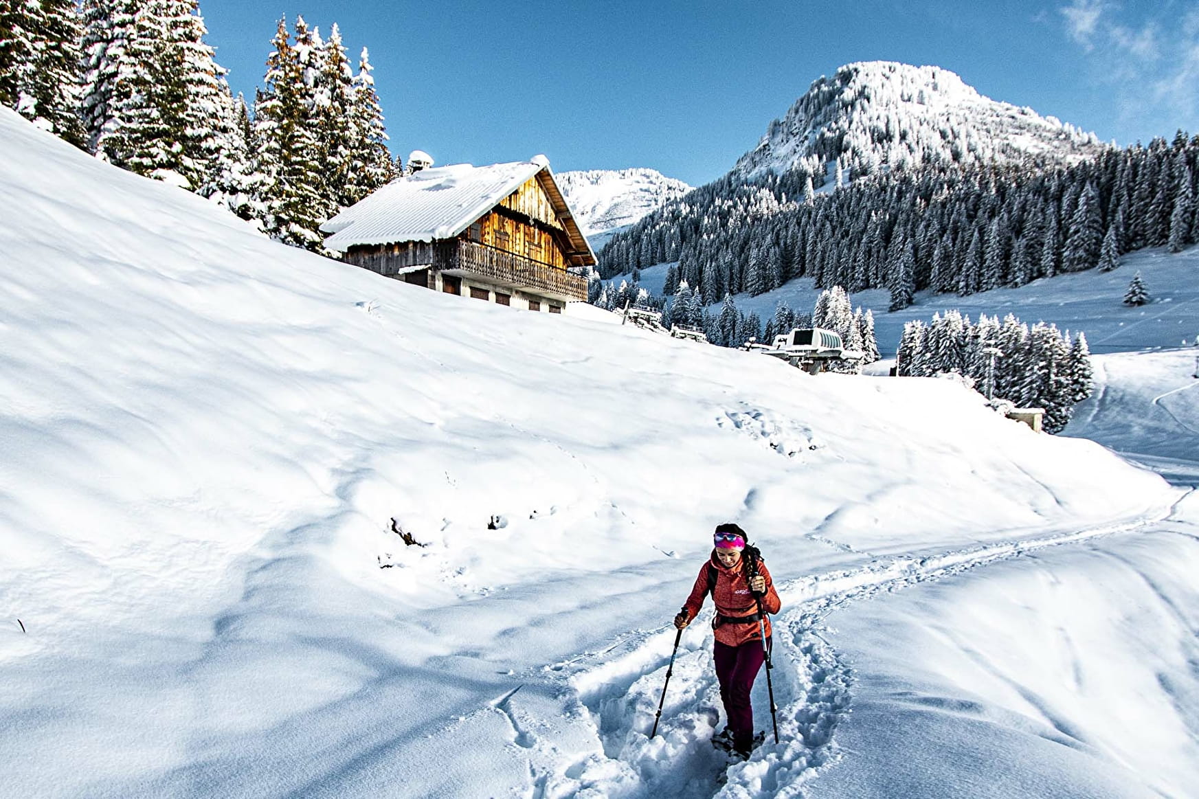
This easy trail takes you between forest and mountain pastures to the sunny Petit-Châtel area, offering panoramic views of the village of Châtel and the Vallée d'Abondance.
About
Prices
Free access.
Reception
Safety and rules of good practice:
- All routes are undertaken at the hiker's own risk, as they are not supervised.
- Before setting off, make sure you are aware of the weather conditions and the risk of avalanches, and remember to bring warm, waterproof clothing. Mountain weather changes very quickly. A high avalanche risk means that trails are closed.
- Choose a route suited to your level and physical condition.
- Follow the signposting instructions.
- Do not stray from the marked routes.
- Tell someone close to you about your outing and the route you have chosen.
- Never hike alone.
- Don't leave too late in the afternoon to make sure you're back before dark.
- Do not use the cross-country or downhill ski runs. Crossing the pistes is only permitted on marked crossings.
- Take plenty of food and water with you. Mountain sports require a lot of energy. Mountain inns and high-altitude restaurants exist on certain routes.
Equipment required :
- A hat
- Gloves
- Sunglasses
- Poles
- Mountain boots
In the bag :
- Warm clothing
- Hot drinks and snacks
- Mobile phone
- First-aid kit
- Sun cream.
Period of practice
From 23/12 to 21/04.
Accessible according to climatic conditions and is closed if the avalanche risk is 4 on 5 for the upstream trail and 5 on 5 for the downstream trail. Please contact the Tourist Office in advance to find out the conditions of access at the time.
Subject to snow conditions.
- Pets welcome
- Parking
Contacts
Access
