
Head towards Villapeyron and park in the sawmill car park. The route starts at the top of the Chemin de Villapeyron, 50m from the car park.
The path enters undergrowth, crosses a stream and climbs straight up until it reaches a forest track. From here, take the winding path up to the oratory.
Continue along the path rising to the right of the oratory and join the wide path leading to the Boudîmes mountain pasture. Cross the mountain pasture to reach a small plateau behind the high-voltage pylon.
The route then rises gently through the mountain pastures, the panorama opening up as you climb and you can see the Dents du Midi (3,257m).
Once you reach Les Québales-bas, leave the left-hand path leading into the forest and take the path to the top of the route.
You're in the Mont de Grange game reserve, and if you're patient and quiet, you might just catch a glimpse of some chamois!
The return journey takes the same route, but don't venture beyond the Québales where the risk of avalanches is high.
- Sport
Snowshoe trail - Les Québales
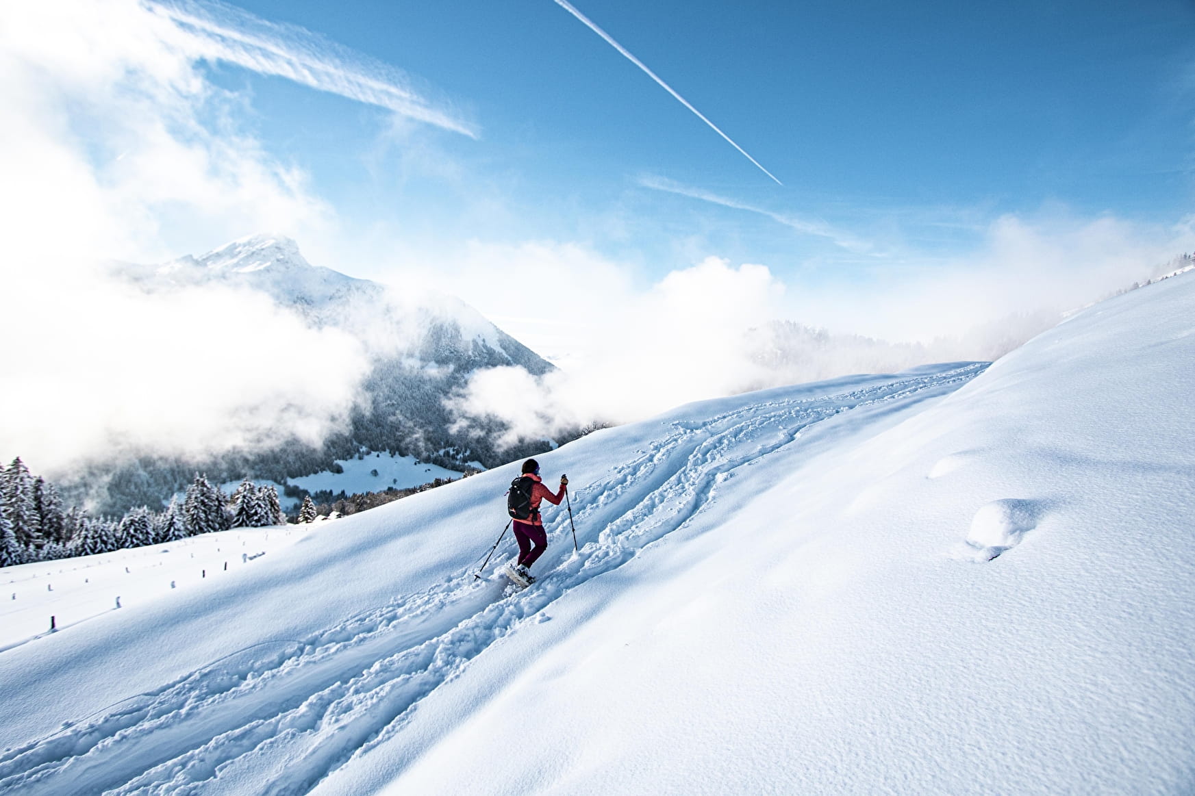
This woodland route, for experienced walkers only, is located in the Mont de Grange nature reserve, where chamois can be seen!
About
Prices
Free access.
Reception
Safety and rules of good practice:
- All routes are undertaken at the hiker's own risk, as they are not supervised.
- Before setting off, make sure you are aware of the weather conditions and the risk of avalanches, and remember to bring warm, waterproof clothing. Mountain weather changes very quickly. A high avalanche risk means that trails are closed.
- Choose a route suited to your level and physical condition.
- Follow the signposting instructions.
- Do not stray from the marked routes.
- Tell someone close to you about your outing and the route you have chosen.
- Never hike alone.
- Don't leave too late in the afternoon to make sure you're back before dark.
- Do not use the cross-country or downhill ski runs. Crossing the pistes is only permitted on marked crossings.
- Take plenty of food and water with you. Mountain sports require a lot of energy. Mountain inns and high-altitude restaurants exist on certain routes.
Equipment required :
- A hat
- Gloves
- Sunglasses
- Poles
- Mountain boots
In the bag :
- Warm clothing
- Hot drinks and snacks
- Mobile phone
- First-aid kit
- Sun cream.
Period of practice
From 23/12 to 21/04.
Accessible according to climatic conditions and is closed if the avalanche risk is 4 on 5. Please contact the Tourist Office in advance to find out the conditions of access at the time.
Subject to snow conditions.
- Pets welcome
- Parking
Contacts
Access
Starting point accessible by shuttle bus line 1 or line 2, Villapeyron stop.
