To get to the start of the trail from the village centre, take the route de Pré la Joux and park at the Pré la Joux chairlift car park.
You can also take the line 1 shuttle bus to the "Télésiège de Pré la Joux" stop.
The path begins by climbing gently above the carpet tunnel and then dips slightly into the forest along the stream.
Cross the stream on a small bridge to emerge above the bobsleigh run. Continue along the right-hand path, again through the forest, as far as "La place des plaines", where there is an oratory. The route then turns left to reach the Grands Plans mountain pastures.
Follow the track and markings through these magnificent areas to the Col de Bassachaux, where you can enjoy a panoramic view of the two valleys.
The return journey takes the same route.
If you're feeling more adventurous, you can continue along the summer route to the chalets at Plaine Dranse. From there, you can return either by the same route or by taking the Pierre Longue chairlift back to Pré la Joux.
You can also take the Pierre-Longue chairlift directly up to the Col de Bassachaux from Plaine-Dranse.
In this case, the difference in altitude is 140m and takes 1 hour (3.4 km).
- Sport
Snowshoe trail - Col de Bassachaux | Plaine Dranse
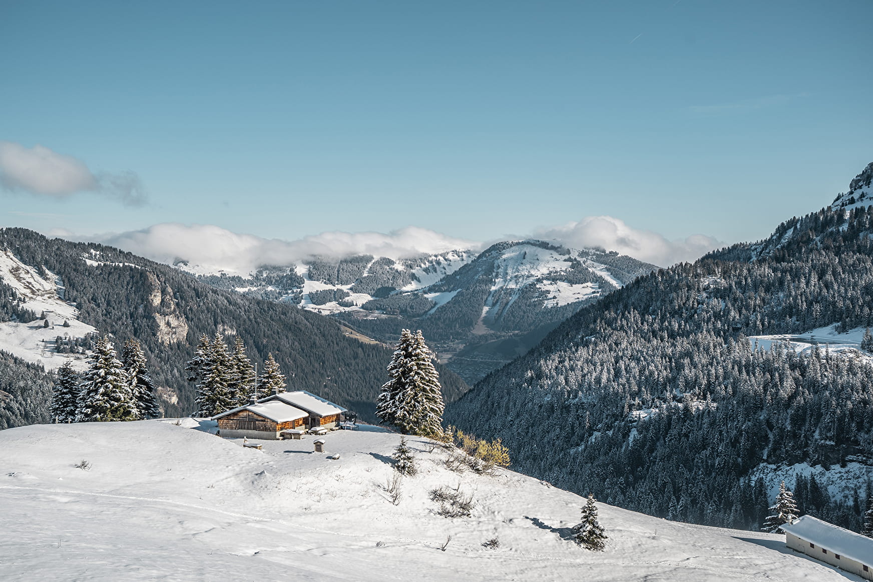
This route, which starts in the forest and leads to the Col de Bassachaux, takes you through some magnificent scenery with panoramic views over the Vallée d'Abondance, the Vallée d'Aulps and Lake Montriond.
About

Prices
Free access. A pedestrian ticket is required if you choose to use the chairlift.
Reception
Safety and rules of good practice:
- All routes are undertaken at the hiker's own risk, as they are not supervised.
- Before setting off, make sure you are aware of the weather conditions and the risk of avalanches, and remember to bring warm, waterproof clothing. Mountain weather changes very quickly. A high avalanche risk means that trails are closed.
- Choose a route suited to your level and physical condition.
- Follow the signposting instructions.
- Do not stray from the marked routes.
- Tell someone close to you about your outing and the route you have chosen.
- Never hike alone.
- Don't leave too late in the afternoon to make sure you're back before dark.
- Do not use the cross-country or downhill ski runs. Crossing the pistes is only permitted on marked crossings.
- Take plenty of food and water with you. Mountain sports require a lot of energy. Mountain inns and high-altitude restaurants exist on certain routes.
Equipment required :
- A hat
- Gloves
- Sunglasses
- Poles
- Mountain boots
In the bag :
- Warm clothing
- Hot drinks and snacks
- Mobile phone
- First-aid kit
- Sun cream.
Period of practice
From 23/12 to 21/04.
Accessible according to climatic conditions and is closed if the avalanche risk is 3 on 5. Please contact the Tourist Office in advance to find out the conditions of access at the time.
Subject to snow conditions.
- Pets welcome
- Accessible via ski lift
- Car park
Contacts
Access
Car park.
Accessible by shuttle bus, line 1 "Pré la Joux chairlift" stop.

