This walk also enables you to explore the area’s military history, most notably the remnants of the Maginot Line (1931/1940) at Les Rochilles. Follow the track to the Granges des Mottets, and then take the path on the right to the Lac des Cerces. From the lake, follow the GR57 to the Col des Cerces. Once over the Col, a path leads down to the Lac Rond and the Lac du Grand Ban. Go round them on the right, and then go to the Col des Rochilles and the camp of the same name. Follow the track back to Les Mottets and Plan Lachat. Type of itinerary: circuit. Maps: IGN Top 25 n° 3435 ET Valloire, Aiguilles d’Arves, Col du Galibier.
Guidebook: La Maurienne à pied ref: P731.
- Sport
Les trois lacs
Savoie Mont Blanc's choice
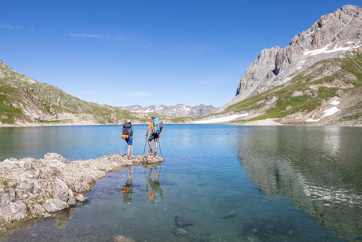
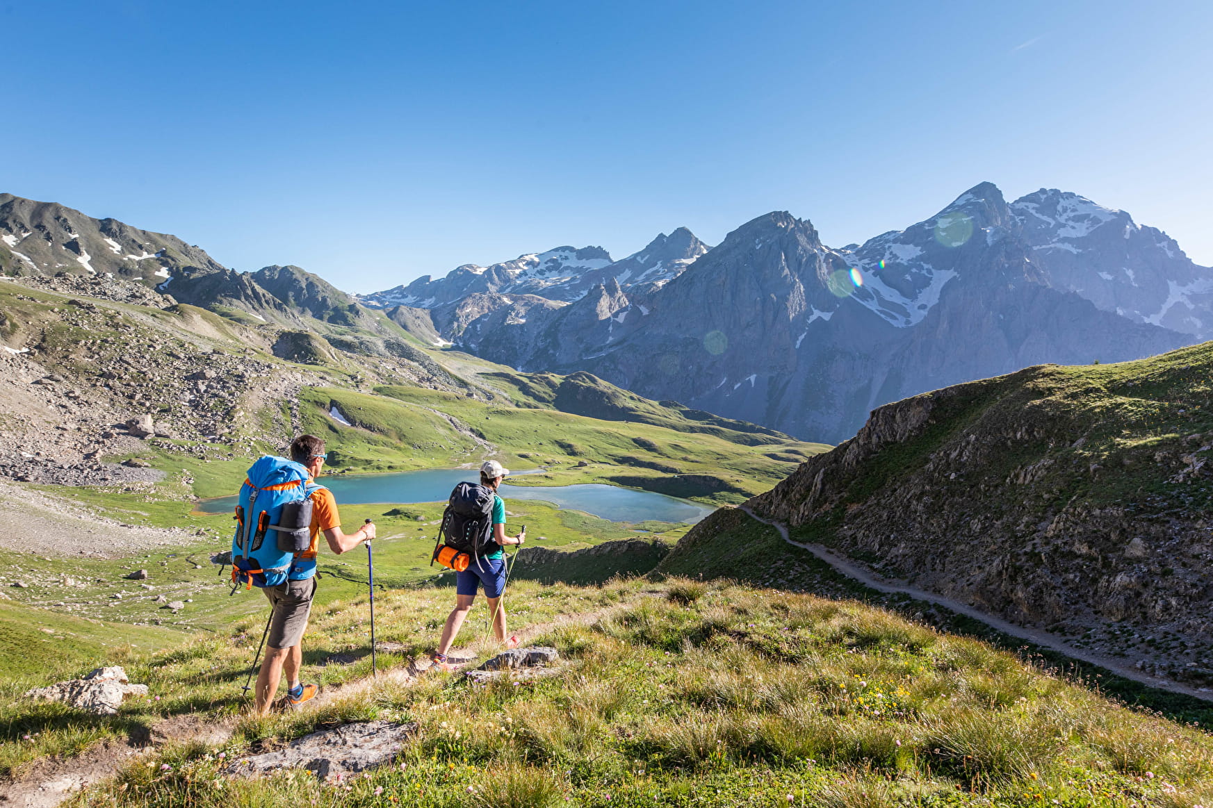
Below the Galibier, the jagged mountains of the Cerces are split by several passes that give access to the “département” of Les Hautes Alpes. The Lacs de Cerces are undoubtedly the brightest jewel in the area’s crown.
Sport Les trois lacs Valloire
About
Further informations
Rock, Stone, Ground, Grit
1 2


- Find out about weather conditions before you leave.
- This hike takes place in summer when there is no more snow.
- Inform someone of your itinerary, as communication may be limited.
- It's best to leave in the morning, so as not to be surprised by the dark, and let someone know if you're going alone.
- The routes you take are your own responsibility.
- Choose an itinerary suited to your physical and technical ability. If in doubt, don't hesitate to contact mountain professionals.
- Make sure you're properly equipped to hike safely and cope with the vagaries of the weather. There are a few things you can do to make your experience safer and more enjoyable. Walking poles improve balance in the event of icy crampons, and regular hydration is essential.
Carry a water bottle and snacks to keep your energy up. Protect yourself from the sun with sunscreen and sunglasses. Don't forget binoculars to add a touch of observation to your adventure.
Start: From the Plan Lachat parking lot at 1980 m altitude, take the military trail to the Mottets barns.
1/ Take the path on the right towards Lac des Cerces.
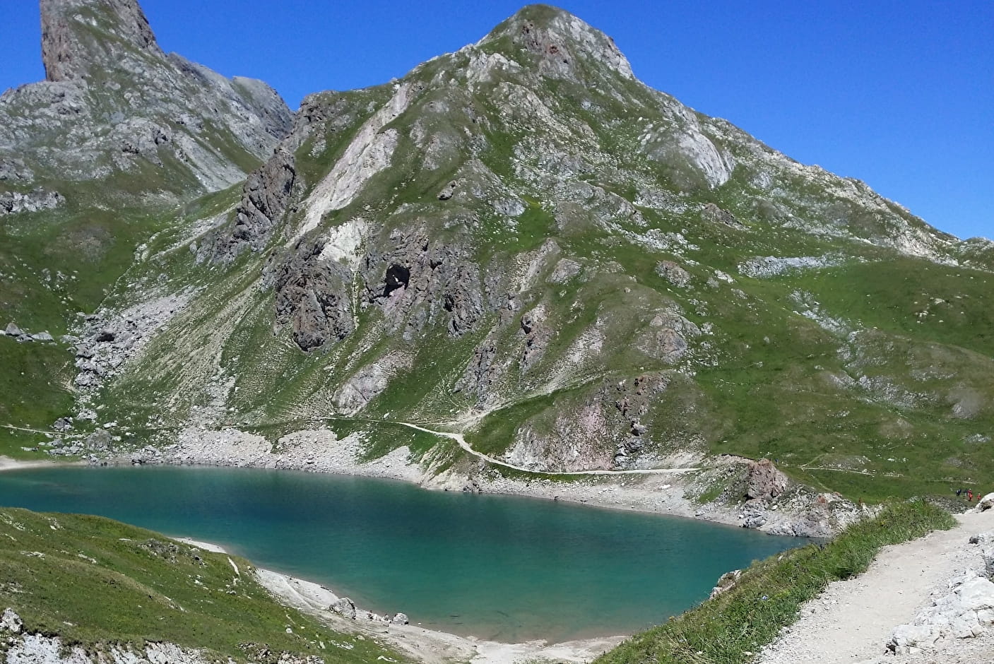
2/ At the lake, turn left on the GR 57 towards the Col des Cerces. 3/ Once over the pass, the path descends between Lac Rond and Lac du Grand Ban.
4/ Skirt both lakes on the right, then continue towards the Col des Rochilles.
5/ At the Rochilles camp, join the Plan Lachat parking lot, descending along the hiking trail.
6/ Cross the small Jargette stream and continue down to Plan Lachat.
7/ At the end of the trail, follow the Mottet track to the Plan Lachat parking lot.
Reception
Period of practice
Throughout the year : open daily.
Services
- Pets welcome
- Restaurant
- Car park
- Free car park
Contacts
Access
From Valloire, follow the Col du Galibier road for 8 km. Just before the last bridge over the River Valloirette, park on the left in the Plan Lachat car park.