From Rontalon Parking to Sur le Coux: 40 minutes
Follow the tarmac road for 200 meters to the hamlet of Rontalon. The path begins on the left in the pastures. The path continues, marked with 8 explanatory panels on fauna, flora and forest to join the tarmac road. Follow the signs. You reach the asphalt road again, until Sur le Coux.
From Sur le Coux to Le Coux de Marignier: 20 minutes
Take the road suitable for vehicles, to the right of the Auberge de la Pointe d'Orchex to Coux de Marignier.
From Coux de Marignier to Nierfait: 35 minutes
Descend by the path that plunges into the forest. Follow the signs to Bourbonnyre and Nierfait.
From Nierfait to Rontalon Parking: 25 minutes
At a place called Nierfait, take the road on the left, and pass a bus stop
Nierfait. Continue straight on the road until the next markup. The path
go down a little on the right, and go up a little further. At road level,
continue right until the bus stop "la Riolle". Cross and climb the Riolle road and follow the signs to reach the starting point.
- Sport
Thyez and its interpretation trail - Hike
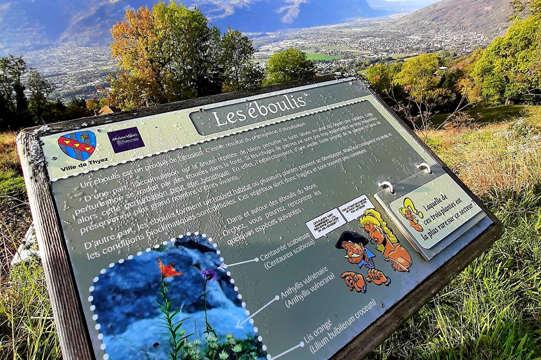
The Pointe d'Orchex offers you a superb panorama over the Arve valley, the Môle and the Bargy Massif. Designed for young and old, this fun and educational route is offered to you to understand the characteristic environment of the territory.
About

Signs
The trail is marked with signs.
Map references
TOP 25 IGN 3430 ET
Further informations
Ground, Grit


Respect the wildlife and the flora already weakened by winter. Keep your dogs on a leash. Bring back your rubbish
Thyez is a city whose economy and urban landscape are marked by
industry (watchmaking then bar turning). Many Gallo-Roman remains have been found during excavations around the Roman parish church.
Prices
Free access. Detailed sheet available at the Tourist Office.
Reception
Keep your dog on a leash, he can scare off herds and wild animals.
Period of practice
From 01/04 to 15/11.
Subject to favorable weather.
- Pets welcome


