• Leisure

"The Transbeaufortain" on foot

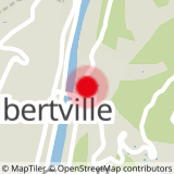
Let us connect the city with the mountain thanks to this path which leaves from Albertville and leads you up to the villages of Beaufortain, on foot, on horseback or in MOUNTAIN BIKE until Beaufort to Hauteluce.

Leisure "The Transbeaufortain" on foot Beaufort

About

Departing from Beaufort (73270)
Average length : 05h30
Total elevation gain : 810m
Vertical drop : 810m
Distance : 22km
Signed walking trail
Animals allowed

Way and back
Total elevation gain : 810m
Vertical drop : 810m

Reception

Animals allowed
Languages spoken : French

Services
  • Pets welcome

Access

73270 Beaufort
Departing from : Beaufort (73270)
Latitude : 45.676682 - Longitude : 6.396017
Moving across the city : Les Saisies (73620), Queige (73720), Arêches-Beaufort (73270), Hauteluce (73620), Villard-sur-Doron (73270), Beaufort (73270)
Information update on 06/07/2023 by Communauté d'agglomération Arlysère