
Starting point: Champagny Le Haut, dam in La Couaz
Arrival: idem
Duration: 3:45 hrs
Longer and more difficult alternative route (red level) than the trail 8b : the Plan des Gouilles refuge.
- Sport
The Plan des Gouilles refuge by the Enclos du Seil
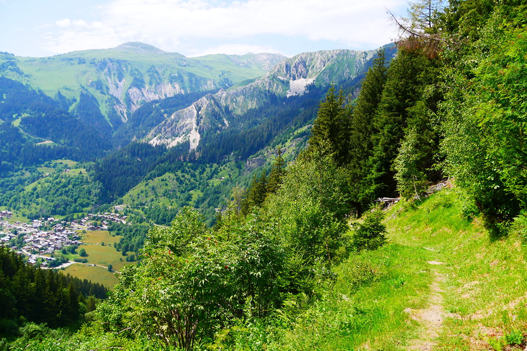
Let yourself be carried away in the beautiful forests on the northern slope in the dale of Champagny. This itinerary takes you over the Pontille Gorges up to the Plan des Gouilles refuge.
Sport The Plan des Gouilles refuge by the Enclos du Seil Champagny-en-Vanoise
About

Topoguides references
Sheet n°8 from the guide book.
Further informations
Rock, Stone, Ground
1 4


0/ From the car park (alt. 1448m), cross the wooden bridge over the Doron. Take the path on the right which rises in the forest (sign) and crosses above the Gorges de la Pontille. Continue straight ahead, the itinerary crosses the stream and the Combe de Verdon in the direction of the meadows and chalets of the Enclos du Seil (alt. 1690 m).
1/ From there, at the two crossroads, turn left towards the Chalet de Méribel which is reached in about 30 minutes (alt. 2004 m.). The path crosses the grassy slopes of the Méribel mountain (alpine pasture) to the left and ends up under a rocky ridge.
2/ The path steepens after a slightly aerial crossing, it continues on the side between spruce trees and boulders (magnificent clear view). It is advisable to be careful as the path runs on slabs of rock that are slippery in case of humidity or rain.
3/ Further on, the path goes downhill and in a few hairpin bends, it leads to a large valley, which you cross to reach a large scree.
4/ Here, take the path which rises on the right, in a few hairpin bends on a final steep slope which allows you to reach the Plan des Gouilles refuge in 30 minutes.
The refuge offers a welcoming terrace: it's an opportunity to have a drink, a bite to eat or even spend the night in this exceptional site (tel: 06 08 98 19 02 / refugeplandesgouilles@ffcam.fr).
Superb viewpoint:
Towards the bottom, you can overlook the whole Champagny le Haut valley. Opposite, admire the Dôme de Bellecôte and the Mont Blanc ...
DESCENT :
Take the route up to the crossroads; here the path descends steeply along the line of a ridge, zigzagging to enter the forest below.
5/ At the crossroads (alt.1775 m.), turn left (sign) towards La Couaz. The path goes down into the forest, dips to the right and leads back to the dam (starting point).
Prices
Free access.
Reception
Period of practice
From 01/05 to 01/11.
Subject to favorable snow and weather conditions.
Services
- Pets welcome
- Car park
- Free car park
Contacts
Access
- Not accessible in a wheelchair


