

Set off at a brisk pace on the Chemin du Petit Bonheur, a trail cherished by
locals, and take in the invigorating scents of spruce and fir trees. Under the
watchful eye of the green woodpecker, you'll only hear the sound of its beak
on the weathered tree trunks.
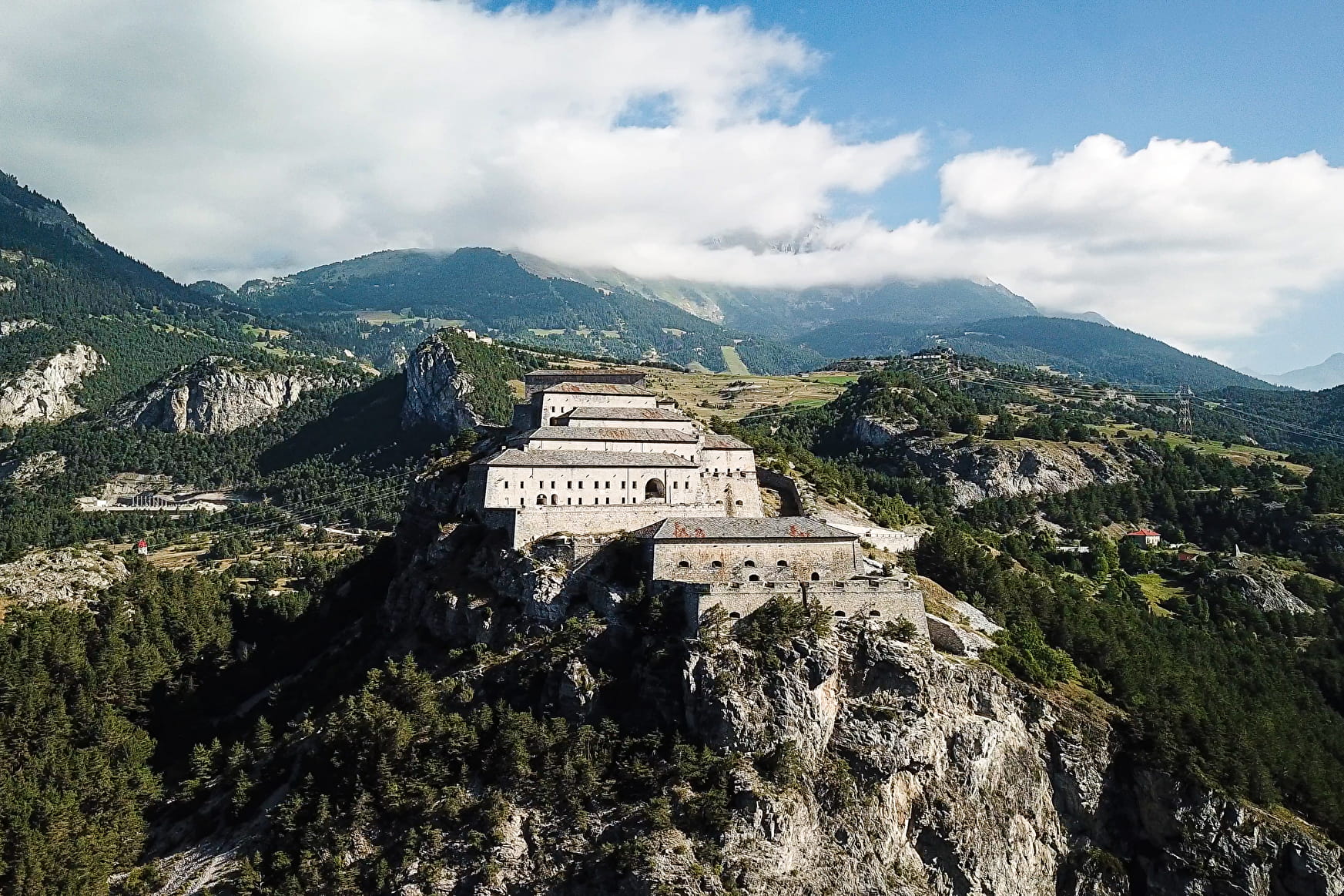
Standing proud on its unconquerable promontory, the giant of the valley offers
you a journey into the military history of Haute Maurienne Vanoise, that takes
just a few minutes. A true emblem of the valley, Redoute Marie-Thérèse has
become the iconic representative of the five Esseillon forts. Awe-inspiring?
To say the least! Their construction began in 1817 to protect the kingdom
of Piedmont-Sardinia from possible French attacks. Massive, monumental,
they form a row at the narrowest point of the valley.
And what about Pont du Diable (Devil's Bridge) as sensational as its height
above the gorges is breathtaking? But fear not, even the most faint-hearted
have managed to cross it, so you can do it too!
- Sport
From Val Cenis Bramans to the Forts
Set out to conquer the Esseillon forts. From one side of the Arc river to the
other you'll take a magical leap back in time. This shady walk takes you on
a journey to discover two hundred years of local history. Ever unperturbed,
the Redoute Marie-Thérèse awaits you!

Sport From Val Cenis Bramans to the Forts Val-Cenis
About
Signs
Mixed signposting (PR and GR)
Map references
Map and booklet "Walks and Hikes Haute Maurienne Vanoise" (sold for € 10 at the Tourist Office)
Topoguides references
Blue route n°37
Further informations
Rock, Ground
Prices
Free access.
Reception
Pets allowed on leash only.
Period of practice
From 01/05 to 15/10.
Subject to favorable snow and weather conditions.
Services
- Pets welcome
- Parking
Contacts
Access
By bus: line S53 - Les Glières stop.
By car: park in the Val Cenis Bramans town hall parking lot.