

After a gradual ascent, venture through the Pierres Longues pastures, to the sound of whistling marmots. They live here in the sunny season. In spring and autumn, herds graze peacefully. In the height of summer, it's not uncommon to spot farmers haymaking. A quick detour to your left and a short break in the sheltered rock caves of Les Mandes make you picture the Belle and Sebastian film set. Cool off at the Ravine stream. In the Pramaria Forest, you might just receive a visit from a few deer. Hidden from view, they share their home with the mountain hare. Waterfalls and streams create the backdrop of choice for your journey to the Adroit meadows. Don't forget to take a break at St-Jean Baptiste chapel for a taste of culture before heading back to Val Cenis - Lanslebourg, along the peaceful Chemin du Petit Bonheur. Don't you feel like you've now gone through all the myriad moods of a mountain village?
- Sport
Les Mandes circuit
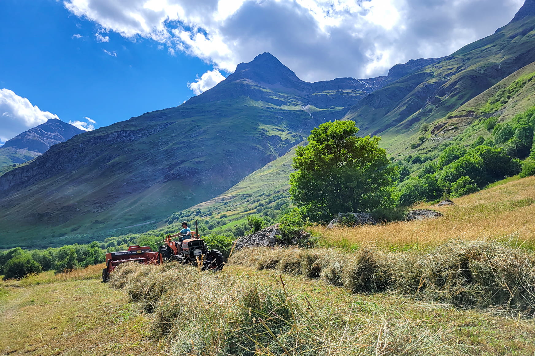
Travelling from stream to stream, explore a south-facing slope where alpine meadows merge with forests. Accessible almost all year round, this route is full of variety. In winter, the frozen streams attract your attention.
Sport Les Mandes circuit Val-Cenis
About
Signs
Yellow departmental markings
Difficult passages
Streams in spring
Map references
Map and booklet "Walks and Hikes Haute Maurienne Vanoise" (sold for € 10 at the Tourist Office)
Topoguides references
Orange route n°64
Further informations
Rock, Stone, Ground
1 1

To guide you in the field, consult the "step-by-step" directional diagram provided in pdf.
Prices
Free access.
Reception
Pets allowed on leash only.
Period of practice
From 15/05 to 15/10.
Subject to favorable snow and weather conditions.
Services
- Pets welcome
- Parking
- Public WC
- Charging stations for electric vehicles
Contacts
Access
By bus: line S52 or S53 - Lanslebourg Tourist Office stop.
By car: park in the parking lot in front of the Gendarmerie.
