Start from FLUMET, at the Tourist Office car park. Follow directions to LE GÂTEAU via Le Char, Bellevarde, Les Balmettes and Trélachat.
Return to FLUMET by going down to Le Sciozier, Le Pont de Fer, La Touvière, Le Biollay, Le Petit Biollay, Les Pontets-Morettes and Le Châtelet.
TO SEE :
The orientation panel on Le Gâteau giving a 360° display of the peaks in the Mont-Blanc range of mountains and the Chaîne des Aravis.
INTERESTING FACT :
La Pierra Menta, which is easily recognisable because it divides the Beaufortain mountain range, is said to have been kicked there from afar by the mythical giant Gargantua when he stepped over the Aravis mountain range. The Pierra Menta mirrors the space in the rocks at the Col des Aravis.
- Sport
Le Gâteau
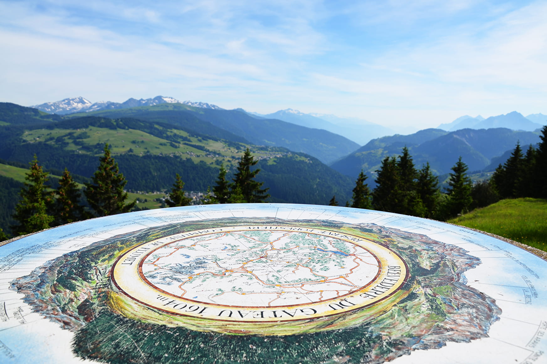
Nice day hike to reach Le Gâteau in 2 1/2 hours without great difficulty. Up there, a beautiful 360 ° panoramic view awaits you.
Sport Le Gâteau Flumet
About

Signs
Marked with yellow signs.
Prices
Map of walking routes on sale at the Tourist Office at € 9.
Methods of payment accepted : Cash
Reception
Period of practice
From 01/06 to 31/10.
Services
- Pets welcome
- Picnic area
- Orientation board
Contacts
Access
Start of the trail in the parking lot of the Tourist Office, parking available.