The main departure is at the top of the Planchamp gondola, but you can also start this loop at the top of the Lanchettes chairlift, the Celliers gondola, or the Col de la Madeleine.
From the start, the landscape is magnificent with a panoramic view over the Morel valley, the Lauzière massif, the Cheval Noir (2832m) and its summer snowfields, or even Mont-Blanc in the background. A short descent on an alpine track will lead you to the Altisurface before going up towards Arenouillaz (2020m). You then reach the arrival plateau of several ski lifts, the heart of the Valmorel ski area. You can then see the Col de la Madeleine and its chalet-restaurants.
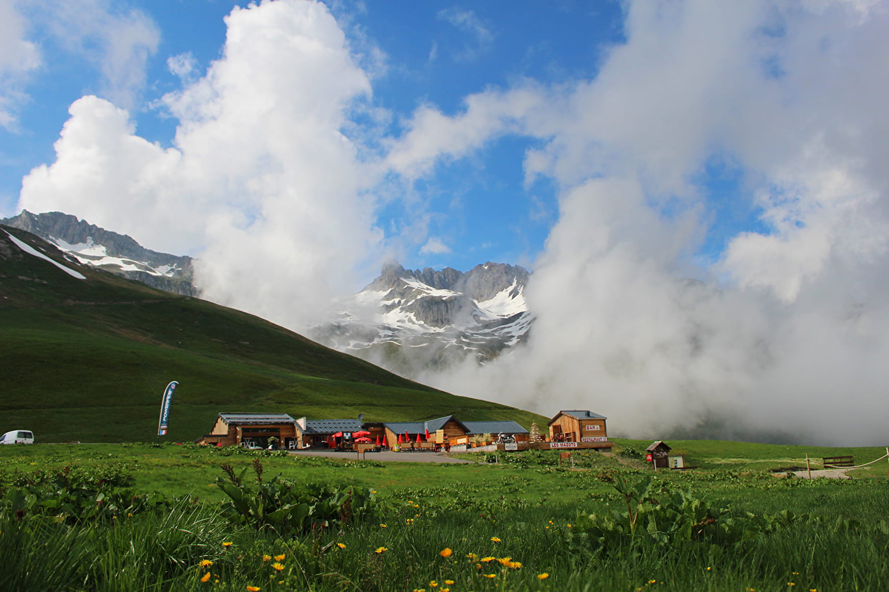
After a long, relatively flat portion, the path rises a little more to allow you to reach the top of the Madeleine chairlift (2185m), the highest point of the loop. The descent that follows on an alpine track will take you to the famous Col de la Madeleine (2,000m). Landscape reading tables and thematic tables will allow you to learn a little more about this Mecca of the Tour de France. You will then descend into the Rave valley, via a small path with many switchbacks. This long portion will take you to Le Rozet. After a short climb, you will follow the Eau Rousse valley on a balcony path. Admire the magnificent panorama of the La Lauzière massif and its steep peaks. After passing through Petit Mucillon, you reach Le Biard (1560m). If you are constrained by time, a variant makes it possible to join the station of Valmorel, while passing by Montolivet.
The route then follows a carriage track which bypasses the Montagne de Tête.
After passing the crossing at the Biollène chairlift, you will return to the top of the Planchamp gondola from where you can descend to the Valmorel station.
Environment: mountain pastures
Point of interest: panoramas on the summits of the La Lauzière massif, of the Cheval Noir, Col de la Madeleine, pastoral setting, herds
Difficulty: no particular technical difficulty, apart from a more hanging passage down the Col de la Madeleine
Total distance: 16 km (14.5 km if return by variant via Montolivet)
Elevation + total: 700 m (350 m if return by variant via Montolivet)
Estimated time: 7 to 8 hours (5:30 to 6:30 if return by variant via Montolivet)
- Sport
Le Col de la Madeleine - B25
A route to reach the legendary Col de la Madeleine, to be planned for the day because of its length.
Sport Le Col de la Madeleine - B25 Valmorel
About

1 4


Prices
Free access.
Reception
Period of practice
From 01/06 to 31/10.
Services
- Pets welcome


